As an affiliate partner, One of Seven Project earns a commission for purchases made through any product, brand logo links, or banner ads on this page. Thanks for your support!
Being that I’m also a Triple Crown thru-hiker I’m used to quality planning tools. After finishing the Bikepacking Triple Crown I realized bikepacking didn’t have quality planning tools available. The Project’s Planning Aids and Resources are our answer to this.
After 100’s of hours of research, 1000’s of keystrokes, more emails and phone calls than I can recall the One of Seven Project’s Arizona Trail Race Planning Aids are done. They’re the ultimate planning resources for the Arizona Trail Race. They contain everything you need to plan and execute your race/ride of the AZTR. If you can’t find what you’re looking for in these then it’s probably in our Arizona Trail Resources.
Shopping with our affiliates helps fund the development of content like this.


One package including our two most popular planning aids.


One package including all of our planning aids.
ONLY Available in NOBO version and ONLY in US Standard units.
Small Bundle – $40.00 + tax (CO only) *You save $10 when you bundle!
Big Bundle – $60.00 + tax (CO only) *You save $20 when you bundle!


Gives you the most information of any planning aid.


Town List available ONLY as part of the Small or Big Bundle.
Data Sheet includes:
Town List includes:
All versions of the Town Lists are ONLY available as part of the Small or Big Bundles.
ONLY Available in NOBO versions and ONLY in US Standard units.
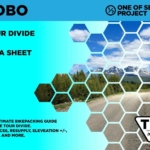
Data Sheet – $25 + Tax (CO only)
Example of Data Sheet
Example of Town List


DATA SHEET and TOWN LIST DIFFERENCES
The Data Sheet has the most info. It gives the distance, elevation +/-, average grade, maximum and minimum elevations, pavement sections, references ACA maps, bike shops, resupply options, and has key notes between two POI. Example: A and B, then B to C, and so on.
The Town List gives cumulative distances between POI. Example: A to B, A to C, A to D. The next section would be B to C, B to D, B to E, and so on. The Town List has distance, elevation +/-, resupply options, bike shops and key notes.
The Town List helps with not having to do the math to figure out how far away things are if they’re not the next POI.


Quickly find the total mileage between any two POI along the route.


Quickly find the total elevation gain between any two POI along the route.
The Mileage and Elevation Gain Charts are ONLY available as part of the Big Bundle.
Example of Mileage Chart
Example of Elevation Gain Chart


Simply clicking on the links below with our affiliates supports the Project.
Or checkout our Deals page to save big!


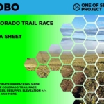 Colorado Trail Race Planning Aids