As an affiliate partner, One of Seven Project earns a commission for purchases made through any product, brand logo links, or banner ads on this page. Thanks for your support!
This Arizona Trail Resource page contains everything you need to plan and execute a rideof the Arizona Trail.
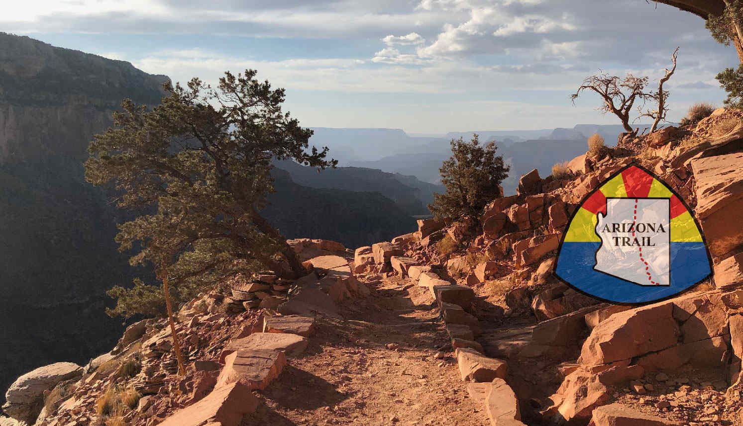
The Arizona Trail is an 800 mile non-motorized multi-use trail that starts on the US/Mexico border south east of Tucson, Arizona. It winds its way to the Arizona/Utah border. The AZT is also part of the National Scenic Trail system.
The trail was conceived by Dale Shewalter, a school teacher from Flagstaff, AZ during he 70’s. In 1985 he walked from Nogales to the Utah state line to see if a trail was possible. Consequently since then the Arizona Trail Association (ATA) has been formed. They work to protect, manage, promote, maintain, and educate the public on all things related to the trail. As a result the trail was completed on December 16, 2011.
The trail crosses through the Kaibab, Coronado, Coconino, and Tonto National Forests, as well as many miles of Bureau of Land Management, and National Parks Service land. Along the way one experiences many variations of desert, to aspen and Pinon Pines.
The trail is open to hikers, horses, and cyclist. Furthermore, it offers challenges and beauty to all its trail users.
This page contains all of the One of Seven Project’s resources related to the Arizona Trail and more. Find out how to plan and resupply, find transportation, to bikepacking resources to help you pack, stay dry or warm, and other helpful tips.
If you’re looking to purchase the Project’s AZT Data Sheet or Town List, you can find them in our store. Both the Data Sheet and Town List are your ultimate guides for everything AZT. Find distances, elevation gain/loss, resupply options, water, and more.
Shopping with our affiliates helps fund the development of content like this.
Everything you need to plan a bikepacking trip on the AZT.
Your ultimate bikepacking guide to the AZT.
 https://oneofsevenproject.com/wp-content/uploads/2018/11/Untitled-design-19.jpg
857
1493
Craig Fowler
http://oneofsevenproject.com/wp-content/uploads/2017/01/1of7-logo-lockup-grey-1132x212-300x56.png
Craig Fowler2020-04-01 08:07:052024-06-20 08:55:35Gear Review - If I Rode the Arizona Trail Race Again
https://oneofsevenproject.com/wp-content/uploads/2018/11/Untitled-design-19.jpg
857
1493
Craig Fowler
http://oneofsevenproject.com/wp-content/uploads/2017/01/1of7-logo-lockup-grey-1132x212-300x56.png
Craig Fowler2020-04-01 08:07:052024-06-20 08:55:35Gear Review - If I Rode the Arizona Trail Race Again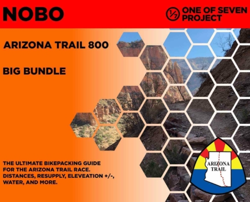 https://oneofsevenproject.com/wp-content/uploads/2020/03/rsz_2024_azt800_bb_10-01.jpg
1276
1651
Craig Fowler
http://oneofsevenproject.com/wp-content/uploads/2017/01/1of7-logo-lockup-grey-1132x212-300x56.png
Craig Fowler2020-03-06 19:57:332024-06-20 08:56:35Arizona Trail Planning Aids
https://oneofsevenproject.com/wp-content/uploads/2020/03/rsz_2024_azt800_bb_10-01.jpg
1276
1651
Craig Fowler
http://oneofsevenproject.com/wp-content/uploads/2017/01/1of7-logo-lockup-grey-1132x212-300x56.png
Craig Fowler2020-03-06 19:57:332024-06-20 08:56:35Arizona Trail Planning Aids https://oneofsevenproject.com/wp-content/uploads/2018/11/Untitled-design-16-1.jpg
857
1493
Craig Fowler
http://oneofsevenproject.com/wp-content/uploads/2017/01/1of7-logo-lockup-grey-1132x212-300x56.png
Craig Fowler2019-05-17 22:59:342024-07-24 09:25:10Ultimate Arizona Trail Bikepacking Planning Guide
https://oneofsevenproject.com/wp-content/uploads/2018/11/Untitled-design-16-1.jpg
857
1493
Craig Fowler
http://oneofsevenproject.com/wp-content/uploads/2017/01/1of7-logo-lockup-grey-1132x212-300x56.png
Craig Fowler2019-05-17 22:59:342024-07-24 09:25:10Ultimate Arizona Trail Bikepacking Planning Guide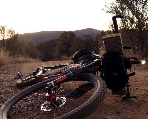 https://oneofsevenproject.com/wp-content/uploads/2018/11/philipinrepose-oneofsevenproject.jpg
857
1493
Craig Fowler
http://oneofsevenproject.com/wp-content/uploads/2017/01/1of7-logo-lockup-grey-1132x212-300x56.png
Craig Fowler2019-05-16 04:09:002024-07-24 10:12:23Arizona Trail Transportation Guide
https://oneofsevenproject.com/wp-content/uploads/2018/11/philipinrepose-oneofsevenproject.jpg
857
1493
Craig Fowler
http://oneofsevenproject.com/wp-content/uploads/2017/01/1of7-logo-lockup-grey-1132x212-300x56.png
Craig Fowler2019-05-16 04:09:002024-07-24 10:12:23Arizona Trail Transportation Guide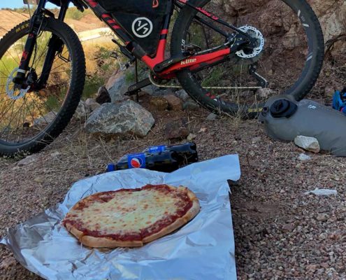 https://oneofsevenproject.com/wp-content/uploads/2018/02/pizza-dinnerofchampions.jpg
857
1493
Craig Fowler
http://oneofsevenproject.com/wp-content/uploads/2017/01/1of7-logo-lockup-grey-1132x212-300x56.png
Craig Fowler2019-05-16 04:07:562024-07-24 11:54:08Arizona Trail Resupply Guide
https://oneofsevenproject.com/wp-content/uploads/2018/02/pizza-dinnerofchampions.jpg
857
1493
Craig Fowler
http://oneofsevenproject.com/wp-content/uploads/2017/01/1of7-logo-lockup-grey-1132x212-300x56.png
Craig Fowler2019-05-16 04:07:562024-07-24 11:54:08Arizona Trail Resupply Guide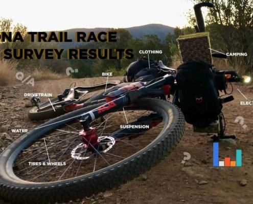 https://oneofsevenproject.com/wp-content/uploads/2019/05/rsz_1aztr_sr_cover_copy-1.jpg
857
1493
Craig Fowler
http://oneofsevenproject.com/wp-content/uploads/2017/01/1of7-logo-lockup-grey-1132x212-300x56.png
Craig Fowler2019-05-09 11:59:202024-06-20 09:05:42Arizona Trail Rider Survey Results
https://oneofsevenproject.com/wp-content/uploads/2019/05/rsz_1aztr_sr_cover_copy-1.jpg
857
1493
Craig Fowler
http://oneofsevenproject.com/wp-content/uploads/2017/01/1of7-logo-lockup-grey-1132x212-300x56.png
Craig Fowler2019-05-09 11:59:202024-06-20 09:05:42Arizona Trail Rider Survey Results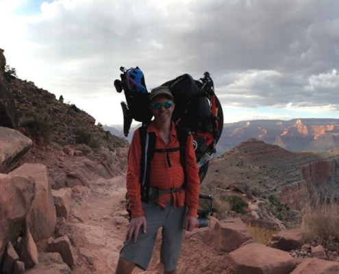 https://oneofsevenproject.com/wp-content/uploads/2020/04/rsz_untitled_design_87.jpg
857
1493
Craig Fowler
http://oneofsevenproject.com/wp-content/uploads/2017/01/1of7-logo-lockup-grey-1132x212-300x56.png
Craig Fowler2020-11-06 08:50:032024-06-20 09:25:11Bikepacking Carrying Harness 101
https://oneofsevenproject.com/wp-content/uploads/2018/11/Untitled-design-19.jpg
857
1493
Craig Fowler
http://oneofsevenproject.com/wp-content/uploads/2017/01/1of7-logo-lockup-grey-1132x212-300x56.png
Craig Fowler2020-04-01 08:07:052024-06-20 08:55:35Gear Review - If I Rode the Arizona Trail Race Again
https://oneofsevenproject.com/wp-content/uploads/2018/11/Untitled-design-16-1.jpg
857
1493
Craig Fowler
http://oneofsevenproject.com/wp-content/uploads/2017/01/1of7-logo-lockup-grey-1132x212-300x56.png
Craig Fowler2019-12-14 15:55:162020-10-28 09:37:33Arizona Trail Race Journal
https://oneofsevenproject.com/wp-content/uploads/2018/11/Untitled-design-16-1.jpg
857
1493
Craig Fowler
http://oneofsevenproject.com/wp-content/uploads/2017/01/1of7-logo-lockup-grey-1132x212-300x56.png
Craig Fowler2019-04-28 09:14:592024-06-20 09:06:41ARIZONA TRAIL RACE RIDER SURVEY
https://oneofsevenproject.com/wp-content/uploads/2020/04/rsz_untitled_design_87.jpg
857
1493
Craig Fowler
http://oneofsevenproject.com/wp-content/uploads/2017/01/1of7-logo-lockup-grey-1132x212-300x56.png
Craig Fowler2020-11-06 08:50:032024-06-20 09:25:11Bikepacking Carrying Harness 101
https://oneofsevenproject.com/wp-content/uploads/2018/11/Untitled-design-19.jpg
857
1493
Craig Fowler
http://oneofsevenproject.com/wp-content/uploads/2017/01/1of7-logo-lockup-grey-1132x212-300x56.png
Craig Fowler2020-04-01 08:07:052024-06-20 08:55:35Gear Review - If I Rode the Arizona Trail Race Again
https://oneofsevenproject.com/wp-content/uploads/2018/11/Untitled-design-16-1.jpg
857
1493
Craig Fowler
http://oneofsevenproject.com/wp-content/uploads/2017/01/1of7-logo-lockup-grey-1132x212-300x56.png
Craig Fowler2019-12-14 15:55:162020-10-28 09:37:33Arizona Trail Race Journal
https://oneofsevenproject.com/wp-content/uploads/2018/11/Untitled-design-16-1.jpg
857
1493
Craig Fowler
http://oneofsevenproject.com/wp-content/uploads/2017/01/1of7-logo-lockup-grey-1132x212-300x56.png
Craig Fowler2019-04-28 09:14:592024-06-20 09:06:41ARIZONA TRAIL RACE RIDER SURVEY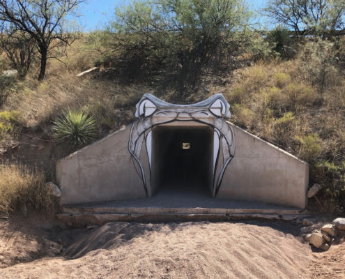 https://oneofsevenproject.com/wp-content/uploads/2018/11/Untitled-design-17.jpg
857
1493
Craig Fowler
http://oneofsevenproject.com/wp-content/uploads/2017/01/1of7-logo-lockup-grey-1132x212-300x56.png
Craig Fowler2018-02-20 14:30:492020-10-28 09:49:57Arizona Trail, Hardest Passages
https://oneofsevenproject.com/wp-content/uploads/2018/11/Untitled-design-17.jpg
857
1493
Craig Fowler
http://oneofsevenproject.com/wp-content/uploads/2017/01/1of7-logo-lockup-grey-1132x212-300x56.png
Craig Fowler2018-02-20 14:30:492020-10-28 09:49:57Arizona Trail, Hardest Passages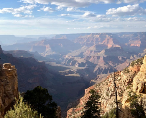 https://oneofsevenproject.com/wp-content/uploads/2018/11/Untitled-design-18.jpg
857
1493
Craig Fowler
http://oneofsevenproject.com/wp-content/uploads/2017/01/1of7-logo-lockup-grey-1132x212-300x56.png
Craig Fowler2018-01-11 13:18:482020-10-28 09:51:32Arizona Trail, Best Bikepacking Passages
https://oneofsevenproject.com/wp-content/uploads/2018/11/Untitled-design-18.jpg
857
1493
Craig Fowler
http://oneofsevenproject.com/wp-content/uploads/2017/01/1of7-logo-lockup-grey-1132x212-300x56.png
Craig Fowler2018-01-11 13:18:482020-10-28 09:51:32Arizona Trail, Best Bikepacking Passages***Please pay attention to the examples for the questions where you have to type in your answer. If answers are not entered EXACTLY like the example I have to go in and correct them and it also throws off the results. Thanks in advance!
Covers: bikes, suspension, tires & wheels, drivetrain, and Components.
Covers: navigation planning, camping, logistic/travel, clothes, and more.
Covers: bikes, suspension, tires & wheels, drivetrain, and Components.
Covers: navigation planning, camping, logistic/travel, clothes, and more.
Being that I’m also a Triple Crown thru-hiker I’m used to quality planning tools. After finishing the Bikepacking Triple Crown I realized bikepacking didn’t have quality planning tools available. The Project’s Planning Aids and Resources are our answer to this.
After 100’s of hours of research, 1000’s of keystrokes, more emails and phone calls than I can recall the One of Seven Project’s Arizona Trail Race Planning Aids are done. They’re the ultimate planning resources for the Arizona Trail Race. They contain everything you need to plan and execute your race/ride of the AZTR. If you can’t find what you’re looking for in these then it’s probably in our Arizona Trail Resources.


One package including our two most popular planning aids.


One package including all of our planning aids.
ONLY Available IN NOBO version and ONLY in imperial units.
Small Bundle – $40.00 + tax (CO only) *You save $10 when you bundle!
Big Bundle – $60.00 + tax (CO only) *You save $20 when you bundle!


Gives you the most information of any planning aid.


Town List available ONLY as part of the Small or Big Bundle.
Data Sheet includes:
Town List includes:
All versions of the Town Lists are ONLY available as part of the Small or Big Bundles.
ONLY Available in NOBO versions and ONLY in imperial units.
Data Sheet – $25 + Tax (CO only)
Example of Data Sheet
Example of Town List


DATA SHEET and TOWN LIST DIFFERENCES
The Data Sheet has the most info. It gives the distance, elevation +/-, average grade, maximum and minimum elevations, pavement sections, references ACA maps, bike shops, resupply options, and has key notes between two POI. Example: A and B, then B to C, and so on.
The Town List gives cumulative distances between POI. Example: A to B, A to C, A to D. The next section would be B to C, B to D, B to E, and so on. The Town List has distance, elevation +/-, resupply options, bike shops and key notes.
The Town List helps with not having to do the math to figure out how far away things are if they’re not the next POI.


Quickly find the total mileage between any two POI along the route.


Quickly find the total elevation gain between any two POI along the route.
The Mileage and Elevation Gain Charts are ONLY available as part of the Big Bundle.
Example of Mileage Chart
Example of Elevation Gain Chart


Simply clicking on the links below with our affiliates supports the Project.
Or checkout our Deals page to save big!


