As an affiliate partner, One of Seven Project earns a commission for purchases made through any product, brand logo links, or banner ads on this page. Thanks for your support!

For more information on the Arizona Trail visit our AZT Resource page. »
The process of getting to either of the Arizona Trail trailheads isn’t terrible, but you do need to do some planning. Lucky for you there’s many transportation services to get you there and back. Traveling can be stressful enough or full of potential pitfalls if you don’t know what you’re doing. I put this Transportation Guide – Arizona Trail together to make it even easier.
To help you navigate your way I put this Arizona Trail Transportation Guide together, covering everything from which airports are closest, how to get from the airport to the trailhead and back, parking options, and the best way to get your bike to the starting line and home again. This Arizona Trail Transportation Guide covers:
Shopping with our affiliates helps fund the development of content like this.
The two most common airports to fly into would be Salt Lake City (SLC) for a start in the North and Tucson (TUS) for a start in the South. I personally few from SLC to TUS when I did my AZT thru-bike and both airports were extremely easy to access and navigate. Both airports are not overly large so you don’t have to drag/carry you bike far.
If by chance you happen to fly one way to either the start or home from the finish as I did, keep in mind that depending on which airline you choose, your bike could cost more to fly than you. Choose wisely!
SLC is an international airport so you have a few options when it comes to airlines. United and Southwest will have the most flight options. The full list includes:
If you choose to fly into SLC your transportation to the northern terminus will look something like this.
Option 1 – Schedule to have a friend pick you up and drive 366 miles (about 6 hours) one way to the Stateline Campground.
Option 2 – Jump on Greyhound and get off in St. George. Then have one services listed below to take you to Stateline Campground. (See notes about taking the bus below).
It is possible you could find transportation to the trail through Craigslist.com or from one of the many Facebook pages for Utah mountain bikers.
Tucson International Airport is your closest airport to the southern terminus. It’s list of airlines is smaller but getting there shouldn’t be a problem. Like the north, getting to the trailhead is the harder part of your approach.
From TUS you can get on the Tucson’s public bus, Suntran.com
(520) 792-9222 and access various parts of the city but no further. Using a shuttle service or a friend is your only option to get to the trailhead. Check on Facebook or on the Forum at Bikepacking.net about carpooling with other riders.
The Project conducts an ongoing rider survey to help new riders try to figure out what gear to use during the Arizona Trail Race. Undertaking a ride/adventure like the AZTR can be very intimidating and the planning can be overwhelming. It’s our hope this survey will help new riders with their planning and execution of their AZTR, as well as help ensure riders are more properly prepared for their adventure.
***Please pay attention to the examples for the questions where you have to type in your answer. If answers are not entered EXACTLY like the example I have to go in and correct them and it also throws off the results. Thanks in advance!

Covers: bikes, suspension, tires & wheels, drivetrain, and Components.
Covers: navigation planning, camping, logistic/travel, clothes, and more.
Surprisingly the Arizona Trail has many shuttle options to to and from the trail. Due to the remoteness of the southern terminus and northern there are no public transportation options available. Below is a list of shuttle services that offer transportation to and from the Arizona Trail. All on the list should be able to accommodate mountain bikes, be sure to ask when you call. Shuttle space can be limited during peak season.
SOUTHERN ARIZONA
Home Grown Mountain Bike Tours – Offers shuttle service between Tucson to the International Border for $55 and $110 to start and back from Picket Post. You can reach them by phone or by email at tara@homegrownmtb.com. 520-237-0129
Southwest Trekking – Offers shuttle service from Mexico to the Gila River. 520-296-9661
Ken’s Shuttle Service – Offers shuttle service for up to 4 hikers to trailhead(s) between Passages 1-13. On- or off-highway travel is available. Call or e-mail kensshuttleservice@gmail.com for pricing information and scheduling. 520-604-6939
Sun & Spokes Bicycle Shop 520-458-0685
CENTRAL ARIZONA
M & B Sedan – Offers shuttle service to and from trailheads on the Arizona Trail between Oracle and Pine/Strawberry. 877-627-3326
Home Grown Mountain Bike Tours – Offers shuttle service between Phoenix to the International Border. You can reach them by phone or by email at tara@homegrownmtb.com. 520-237-0129
Payson Airport Shuttle – Offers shuttle service from both the Phoenix Sky Harbor Airport and Mesa Gateway Airport, servicing Payson, Pine, Strawberry and all points in between, including trailheads. 928-363-0754
NOUTHERN ARIZONA
Circle Tours – Offers shuttle services to various northern Arizona/southern Utah trailheads. Contact Kyle Walker at 888-854-7862.
Paria Outpost – Run by Susan and Stephen Dodson, has a shuttle service. Contact them at 928-691-1047
Ashley World Traveler BNB – Shuttles (to northern terminus, Page airport, and more, shower and laundry, accommodations, caching water, and vehicle storage. 801-616-2070
Destination Services – Offers shuttle services with their 9-passenger van for hikers and mountain bikers. 928-645-2789
The Arizona Trail Association has a larger list on their website if you cannot find a ride to/from the trail with those companies listed here.
Greyhoud SLC to St. George $38
Bike box – Max size 62″ (157cm) combined length+width+height and 50 lbs or less.


One package including our two most popular planning aids.


One package including all of our planning aids.
ONLY Available in NOBO version and ONLY in US Standard units.
Small Bundle – $40.00 + tax (CO only) *You save $10 when you bundle!
Big Bundle – $60.00 + tax (CO only) *You save $20 when you bundle!


Gives you the most information of any planning aid.


Town List available ONLY as part of the Small or Big Bundle.
Data Sheet includes:
Town List includes:
All versions of the Town Lists are ONLY available as part of the Small or Big Bundles.
ONLY Available in NOBO versions and ONLY in US Standard units.
Data Sheet – $25 + Tax (CO only)
Example of Data Sheet
Example of Town List


DATA SHEET and TOWN LIST DIFFERENCES
The Data Sheet has the most info. It gives the distance, elevation +/-, average grade, maximum and minimum elevations, pavement sections, references ACA maps, bike shops, resupply options, and has key notes between two POI. Example: A and B, then B to C, and so on.
The Town List gives cumulative distances between POI. Example: A to B, A to C, A to D. The next section would be B to C, B to D, B to E, and so on. The Town List has distance, elevation +/-, resupply options, bike shops and key notes.
The Town List helps with not having to do the math to figure out how far away things are if they’re not the next POI.


Quickly find the total mileage between any two POI along the route.


Quickly find the total elevation gain between any two POI along the route.
The Mileage and Elevation Gain Charts are ONLY available as part of the Big Bundle.
Example of Mileage Chart
Example of Elevation Gain Chart


Parking at either of the AZT’s terminuses really isn’t an option. Being that the southern terminus is on the US/Mexican border there is no parking available. The northern terminus is quite far from civilization and your car would be easy prey for thieves to break into it. It’s rumored that it’s safe to leave your car here but use your own judgement, two weeks is a long time.
Your best option is to get dropped off by one of the shuttle services listed above. You could also arrange to be picked up by a friend or family member but keep in mind they will have to have a very flexible schedule. The chances you’ll know exactly when you’ll be there are slim.
Your last option is to ride to or from the trailhead. Obviously not the best physical option given what you either are about to do or just did but most likely the cheapest.
Read these next.
Your ultimate bikepacking guide to the AZT300/800.
 https://oneofsevenproject.com/wp-content/uploads/2018/11/Untitled-design-19.jpg
857
1493
Craig Fowler
http://oneofsevenproject.com/wp-content/uploads/2017/01/1of7-logo-lockup-grey-1132x212-300x56.png
Craig Fowler2020-04-01 08:07:052024-06-20 08:55:35Gear Review - If I Rode the Arizona Trail Race Again
https://oneofsevenproject.com/wp-content/uploads/2018/11/Untitled-design-19.jpg
857
1493
Craig Fowler
http://oneofsevenproject.com/wp-content/uploads/2017/01/1of7-logo-lockup-grey-1132x212-300x56.png
Craig Fowler2020-04-01 08:07:052024-06-20 08:55:35Gear Review - If I Rode the Arizona Trail Race Again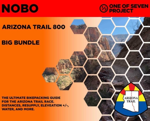 https://oneofsevenproject.com/wp-content/uploads/2020/03/rsz_2024_azt800_bb_10-01.jpg
1276
1651
Craig Fowler
http://oneofsevenproject.com/wp-content/uploads/2017/01/1of7-logo-lockup-grey-1132x212-300x56.png
Craig Fowler2020-03-06 19:57:332024-06-20 08:56:35Arizona Trail Planning Aids
https://oneofsevenproject.com/wp-content/uploads/2020/03/rsz_2024_azt800_bb_10-01.jpg
1276
1651
Craig Fowler
http://oneofsevenproject.com/wp-content/uploads/2017/01/1of7-logo-lockup-grey-1132x212-300x56.png
Craig Fowler2020-03-06 19:57:332024-06-20 08:56:35Arizona Trail Planning Aids https://oneofsevenproject.com/wp-content/uploads/2018/11/Untitled-design-16-1.jpg
857
1493
Craig Fowler
http://oneofsevenproject.com/wp-content/uploads/2017/01/1of7-logo-lockup-grey-1132x212-300x56.png
Craig Fowler2019-05-17 22:59:342024-07-24 09:25:10Ultimate Arizona Trail Bikepacking Planning Guide
https://oneofsevenproject.com/wp-content/uploads/2018/11/Untitled-design-16-1.jpg
857
1493
Craig Fowler
http://oneofsevenproject.com/wp-content/uploads/2017/01/1of7-logo-lockup-grey-1132x212-300x56.png
Craig Fowler2019-05-17 22:59:342024-07-24 09:25:10Ultimate Arizona Trail Bikepacking Planning Guide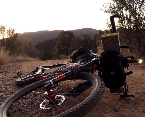 https://oneofsevenproject.com/wp-content/uploads/2018/11/philipinrepose-oneofsevenproject.jpg
857
1493
Craig Fowler
http://oneofsevenproject.com/wp-content/uploads/2017/01/1of7-logo-lockup-grey-1132x212-300x56.png
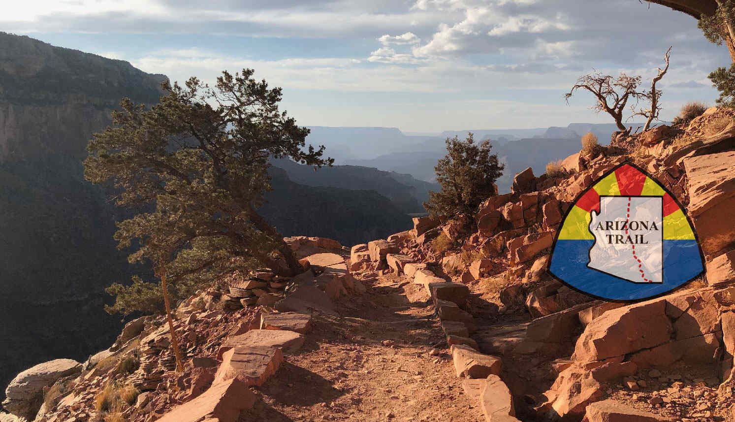
Craig Fowler2019-05-16 04:09:002024-07-24 10:12:23Arizona Trail Transportation Guide
https://oneofsevenproject.com/wp-content/uploads/2018/11/philipinrepose-oneofsevenproject.jpg
857
1493
Craig Fowler
http://oneofsevenproject.com/wp-content/uploads/2017/01/1of7-logo-lockup-grey-1132x212-300x56.png
Craig Fowler2019-05-16 04:09:002024-07-24 10:12:23Arizona Trail Transportation Guide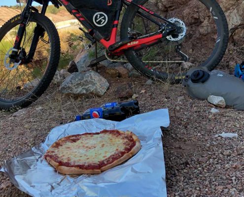 https://oneofsevenproject.com/wp-content/uploads/2018/02/pizza-dinnerofchampions.jpg
857
1493
Craig Fowler
http://oneofsevenproject.com/wp-content/uploads/2017/01/1of7-logo-lockup-grey-1132x212-300x56.png
Craig Fowler2019-05-16 04:07:562024-07-24 11:54:08Arizona Trail Resupply Guide
https://oneofsevenproject.com/wp-content/uploads/2018/02/pizza-dinnerofchampions.jpg
857
1493
Craig Fowler
http://oneofsevenproject.com/wp-content/uploads/2017/01/1of7-logo-lockup-grey-1132x212-300x56.png
Craig Fowler2019-05-16 04:07:562024-07-24 11:54:08Arizona Trail Resupply Guide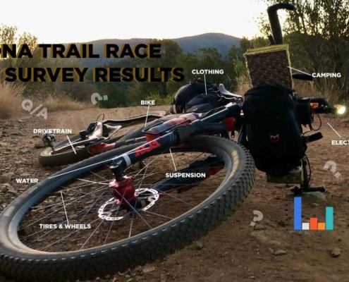 https://oneofsevenproject.com/wp-content/uploads/2019/05/rsz_1aztr_sr_cover_copy-1.jpg
857
1493
Craig Fowler
http://oneofsevenproject.com/wp-content/uploads/2017/01/1of7-logo-lockup-grey-1132x212-300x56.png
Craig Fowler2019-05-09 11:59:202024-06-20 09:05:42Arizona Trail Rider Survey Results
https://oneofsevenproject.com/wp-content/uploads/2019/05/rsz_1aztr_sr_cover_copy-1.jpg
857
1493
Craig Fowler
http://oneofsevenproject.com/wp-content/uploads/2017/01/1of7-logo-lockup-grey-1132x212-300x56.png
Craig Fowler2019-05-09 11:59:202024-06-20 09:05:42Arizona Trail Rider Survey Results


Simply clicking on the links below with our affiliates supports the Project.
Or checkout our Deals page to save big!


