As an affiliate partner, One of Seven Project earns a commission for purchases made through any product, brand logo links, or banner ads on this page. Thanks for your support!

For more information on the Arizona Trail visit our AZT Resource page. »
Have you ever wondered about exploring the Arizona Trail by bike?
I rode it as part of the Bikepacking Triple Crown. The experience was amazing. But it also took a lot of planning. If you’re like me and have a passion for the sometimes extreme, then read on.
I put this page together for people like us, explores and adventurers. I realized there was a need for an Arizona Trail Guide, for bikepackers. The page is broken down into simple sections so you can easily get a feel for the trail. This page is part of a larger all inclusive guide, so you can focus on riding your bike instead of searching the internet for hours on end.
Where does one start? This page is a great start but if you want to know more, checkout the “AZT Resources” button below. But be ready for what comes next. You just might find yourself on a plane bound for Arizona.
Shopping with our affiliates helps fund the development of content like this.
The Project conducts an ongoing rider survey to help new riders try to figure out what gear to use during the Arizona Trail Race. Undertaking a ride/adventure like the AZTR can be very intimidating and the planning can be overwhelming. It’s our hope this survey will help new riders with their planning and execution of their AZTR, as well as help ensure riders are more properly prepared for their adventure.
***Please pay attention to the examples for the questions where you have to type in your answer. If answers are not entered EXACTLY like the example I have to go in and correct them and it also throws off the results. Thanks in advance!

Covers: bikes, suspension, tires & wheels, drivetrain, and Components.
Covers: navigation planning, camping, logistic/travel, clothes, and more.
804 Miles (1293.9km)
8
70,107 Feet (21,368.6 m)
9,007 Feet (2745m)
6—21 Days
65%
90%
April to November
3rd Thursday of October 19, 2024
6 am – 300 @Mexican Border / Monument 103
6 am – 800 @Mexican Border / Monument 103
Tucson, AZ and Kanab, UT
800
Austin Killips (2024) 8:23:27
Katya Rakhmatulina (2023) 9:19:52
300
Timon Fish (2021) 1:14:52
Kaitlyn Boyle (2018) 2:02:57
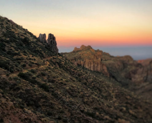
The Arizona Trail is an 800 mile multi use recreational trail that extends from the Mexican border to the Utah border. Completed in 2011 the trail connects some of Arizona’s most beautiful and yet rugged features. Users get to experience historical and cultural sites, the Sonoran Desert to the boreal forests surrounded Flagstaff, the Gila River, Mogollon Rim, San Fransisco Peaks, Superstition Mountains, Grand Canyon, the Kaibab Plateau, canyons, valleys, peaks and more.
Thru-bikers take a slightly different route than their fellow thru-hikers to avoid the many Wilderness areas along the route. The result is bikers travel 804 miles to complete their thru-bike. Using dirt roads, trails, and some pavement thru-bikers circumnavigate Wilderness areas. Thru-biking the AZT is not an easy task. I can’t stress enough how important doing your homework before you go is. The more you know the better your chances of getting to Utah. Trust me I know by experience!
The best times to ride/tour the AZT is during the Spring and Fall. Summer is far too hot and in Winter the higher peaks and ridges are covered in snow. If you choose to ride/tour in the Fall, do not think because it’s Fall the temperatures won’t be hot. I started on Oct. 7, 2017 and during my first four days the temperature was over 95 degrees.
Like any big adventure, the AZT is not something to take lightly. Do your homework, know the route, know your options, and use your head when out there. Help could be hours or days away!


Elevation profiles provided by John Schilling. Support John’s effort by purchasing prints, sticks and mugs of these profiles.
***NOTE MAJOR CHANGES HAVE BEEN MADE TO THE AZT300/800***
Please go to the official website, and review all the current changes and upcoming possible ones. In a nut shell:
AZT300/800
The AZT300/800 are not organized or sanctioned event in any way. They are seen as big group ride that follows a set route, at a set time, a short list of rules and that’s it. Those who take part should understand this and obey the gentleman’s agreement to “race” fairly and follow the rules. There are also no checkpoints, organizers, or aid stations of any kind. You are responsible for yourself, period.
The Arizona Trail (AZT800) starts on the US/Mexico border , while the 300 starts about 14 miles north of the border at the Parker Canyon Lake, usually about one hour later. Both routes follow the same path to PickettPost, the finish the the 300, where the 800 continues to Utah.
October 19, 2024
800 Start: 6 am – Mexican Border / Monument 103
300 Start: 6 am – Mexican Border / Monument 103
60 people, combined, in both events
*Subject to change, See AZTrail for exact info.
RULES
Bikepack racing is usually not organized, is without entry fees or prizes, but there are a set of rules all bikepacking races follow. The rules are put into place to create a level playing field for all those who participate.
*Note these rules are the general rules for bikepack racing and each event may have their own specific rules and they also change from time to time. With that said it’s important you read and understand the official rules which can be found at the link below.
1. One must complete the entire route under their own power.
2. Outside support is not allowed.
3. No caching of food/supplies ahead of time.
4. No use of motorized transportation or hitch-hiking, EXCEPT for travel to hospital/medical care.
The following are allowed, but not encouraged. Please use sparingly.
5. Unplanned assistance from other racers is ACCEPTABLE.
6. Trail magic OK – but please, no begging or fishing (hinting).
7. Mailing resupplies ahead to Post Offices is ACCEPTABLE.
For full rules visit AZTrail.
No entry fee, no prizes, absolutely no support
PERMITS & SPECIAL NOTES
There are two (2) permits needed to ride the AZT800. The 300 does NOT require a license. You need a permit if you plan on sleeping within the Grand Canyon and one to crosses a State Land Trust. The Land trust permit is $15 and can be found here.
You can get your camping permit from the Backcountry Ranger Station at the South Rim Village. Permits are $18. You’ll be getting a walk up permit. Ask if you can stay in the Stock Camp at Phantom Ranch. It’s convent and close to the trail. More information can be found here.
It’s very important to note that it’s illegal for one’s bike wheels to touch the ground inside the Grand Canyon (below the rim). You must carry your bike from the South Rim to the North Rim. The use of the Grand Canyon by riders is by special permission from the Park Service and can be taken away. This is a must, please follow the rules.
SPOT TRACKING
Riders are encouraged to carry a Spot tracker, though they are not mandatory. Due to the remoteness and sheer difficulty of the trail I personal believe you’d be crazy not to. Riders can sign up at Trackleaders.com one month before the event if they choose to.
SPOT HIRE
You can rent a Gen3 Spot from Trackleaders.com around one month before the start of the event. Check Trackleaders or Bikepacking.net forums for information at that time.
SUPPORT THE ATA
The Arizona Trail Association has no ties to the event but they did build the trail and maintain it. It’s through their good graces you have this amazing trail to ride. Please consider joining the ATA. Membership is only $35 and as a member you get additional access to trail conditions, water reports and more on the ATA website.
Being that I’m also a Triple Crown thru-hiker I’m used to quality planning tools. After finishing the Bikepacking Triple Crown I realized bikepacking didn’t have quality planning tools available. The Project’s Planning Aids and Resources are our answer to this.
After 100’s of hours of research, 1000’s of keystrokes, more emails and phone calls than I can recall the One of Seven Project’s Arizona Trail Race Planning Aids are done. They’re the ultimate planning resources for the Arizona Trail Race. They contain everything you need to plan and execute your race/ride of the AZTR. If you can’t find what you’re looking for in these then it’s probably in our Arizona Trail Resources.


One package including our two most popular planning aids.


One package including all of our planning aids.
ONLY Available IN NOBO version and ONLY in US Standard units.
Small Bundle – $40.00 + tax (CO only) *You save $10 when you bundle!
Big Bundle – $60.00 + tax (CO only) *You save $20 when you bundle!


Gives you the most information of any planning aid.


Town List available ONLY as part of the Small or Big Bundle.
Data Sheet includes:
Town List includes:
All versions of the Town Lists are ONLY available as part of the Small or Big Bundles.
ONLY Available in NOBO versions and ONLY in US Standard units.
Data Sheet – $25 + Tax (CO only)
Example of Data Sheet
Example of Town List


DATA SHEET and TOWN LIST DIFFERENCES
The Data Sheet has the most info. It gives the distance, elevation +/-, average grade, maximum and minimum elevations, pavement sections, references ACA maps, bike shops, resupply options, and has key notes between two POI. Example: A and B, then B to C, and so on.
The Town List gives cumulative distances between POI. Example: A to B, A to C, A to D. The next section would be B to C, B to D, B to E, and so on. The Town List has distance, elevation +/-, resupply options, bike shops and key notes.
The Town List helps with not having to do the math to figure out how far away things are if they’re not the next POI.


Quickly find the total mileage between any two POI along the route.


Quickly find the total elevation gain between any two POI along the route.
The Mileage and Elevation Gain Charts are ONLY available as part of the Big Bundle.
Example of Mileage Chart
Example of Elevation Gain Chart


DANGERS & PITFALLS


MAPS / BOOKS / APPS
Read these next.
 https://oneofsevenproject.com/wp-content/uploads/2018/11/Untitled-design-19.jpg
857
1493
Craig Fowler
http://oneofsevenproject.com/wp-content/uploads/2017/01/1of7-logo-lockup-grey-1132x212-300x56.png
Craig Fowler2020-04-01 08:07:052024-06-20 08:55:35Gear Review - If I Rode the Arizona Trail Race Again
https://oneofsevenproject.com/wp-content/uploads/2018/11/Untitled-design-19.jpg
857
1493
Craig Fowler
http://oneofsevenproject.com/wp-content/uploads/2017/01/1of7-logo-lockup-grey-1132x212-300x56.png
Craig Fowler2020-04-01 08:07:052024-06-20 08:55:35Gear Review - If I Rode the Arizona Trail Race Again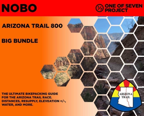 https://oneofsevenproject.com/wp-content/uploads/2020/03/rsz_2024_azt800_bb_10-01.jpg
1276
1651
Craig Fowler
http://oneofsevenproject.com/wp-content/uploads/2017/01/1of7-logo-lockup-grey-1132x212-300x56.png
Craig Fowler2020-03-06 19:57:332024-06-20 08:56:35Arizona Trail Planning Aids
https://oneofsevenproject.com/wp-content/uploads/2020/03/rsz_2024_azt800_bb_10-01.jpg
1276
1651
Craig Fowler
http://oneofsevenproject.com/wp-content/uploads/2017/01/1of7-logo-lockup-grey-1132x212-300x56.png
Craig Fowler2020-03-06 19:57:332024-06-20 08:56:35Arizona Trail Planning Aids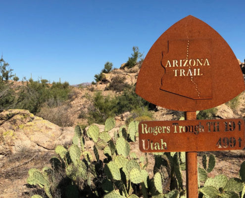 https://oneofsevenproject.com/wp-content/uploads/2018/11/Untitled-design-16-1.jpg
857
1493
Craig Fowler
http://oneofsevenproject.com/wp-content/uploads/2017/01/1of7-logo-lockup-grey-1132x212-300x56.png
Craig Fowler2019-05-17 22:59:342024-07-24 09:25:10Ultimate Arizona Trail Bikepacking Planning Guide
https://oneofsevenproject.com/wp-content/uploads/2018/11/Untitled-design-16-1.jpg
857
1493
Craig Fowler
http://oneofsevenproject.com/wp-content/uploads/2017/01/1of7-logo-lockup-grey-1132x212-300x56.png
Craig Fowler2019-05-17 22:59:342024-07-24 09:25:10Ultimate Arizona Trail Bikepacking Planning Guide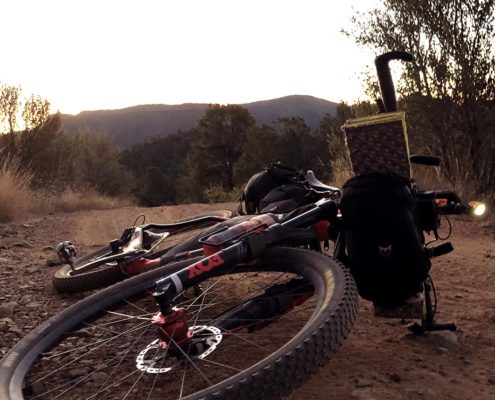 https://oneofsevenproject.com/wp-content/uploads/2018/11/philipinrepose-oneofsevenproject.jpg
857
1493
Craig Fowler
http://oneofsevenproject.com/wp-content/uploads/2017/01/1of7-logo-lockup-grey-1132x212-300x56.png
Craig Fowler2019-05-16 04:09:002024-07-24 10:12:23Arizona Trail Transportation Guide
https://oneofsevenproject.com/wp-content/uploads/2018/11/philipinrepose-oneofsevenproject.jpg
857
1493
Craig Fowler
http://oneofsevenproject.com/wp-content/uploads/2017/01/1of7-logo-lockup-grey-1132x212-300x56.png
Craig Fowler2019-05-16 04:09:002024-07-24 10:12:23Arizona Trail Transportation Guide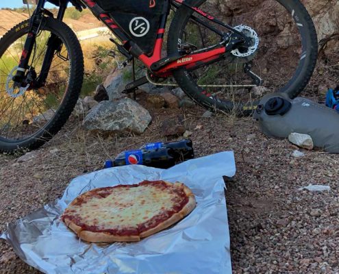 https://oneofsevenproject.com/wp-content/uploads/2018/02/pizza-dinnerofchampions.jpg
857
1493
Craig Fowler
http://oneofsevenproject.com/wp-content/uploads/2017/01/1of7-logo-lockup-grey-1132x212-300x56.png
Craig Fowler2019-05-16 04:07:562024-07-24 11:54:08Arizona Trail Resupply Guide
https://oneofsevenproject.com/wp-content/uploads/2018/02/pizza-dinnerofchampions.jpg
857
1493
Craig Fowler
http://oneofsevenproject.com/wp-content/uploads/2017/01/1of7-logo-lockup-grey-1132x212-300x56.png
Craig Fowler2019-05-16 04:07:562024-07-24 11:54:08Arizona Trail Resupply Guide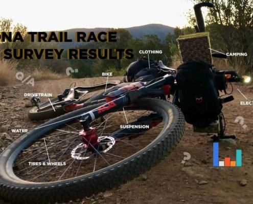 https://oneofsevenproject.com/wp-content/uploads/2019/05/rsz_1aztr_sr_cover_copy-1.jpg
857
1493
Craig Fowler
http://oneofsevenproject.com/wp-content/uploads/2017/01/1of7-logo-lockup-grey-1132x212-300x56.png
Craig Fowler2019-05-09 11:59:202024-06-20 09:05:42Arizona Trail Rider Survey Results
https://oneofsevenproject.com/wp-content/uploads/2019/05/rsz_1aztr_sr_cover_copy-1.jpg
857
1493
Craig Fowler
http://oneofsevenproject.com/wp-content/uploads/2017/01/1of7-logo-lockup-grey-1132x212-300x56.png
Craig Fowler2019-05-09 11:59:202024-06-20 09:05:42Arizona Trail Rider Survey Results


Simply clicking on the links below with our affiliates supports the Project.
Or checkout our Deals page to save big!


