As an affiliate partner, One of Seven Project earns a commission for purchases made through any product, brand logo links, or banner ads on this page. Thanks for your support!
Welcome to your ultimate guide for conquering the Colorado Trail Race (CTR)—a journey celebrated for its rugged beauty, high-altitude challenges, and exhilarating singletrack. At the One of Seven Project, we understand that achieving success in the CTR goes beyond physical endurance and a reliable bike; it requires meticulous planning, preparation, and the right resources.
Our Colorado Trail Race Resources page is crafted to provide you with everything you need to plan, prepare, and thrive on this demanding route. From detailed route information and essential safety tips to expert gear recommendations and comprehensive planning aids, we’ve compiled a treasure trove of resources to support you every mile of the way. Whether you’re a veteran rider or tackling the CTR for the first time, our thorough guides and tools will help you navigate the trail with confidence and optimize your gear setup for ultimate performance.
Explore our curated resources to elevate your journey, enhance efficiency, and ensure a memorable experience on one of the most challenging and scenic bikepacking trails in the world.
Shopping with our affiliates helps fund the development of content like this.
Everything you need to plan a bikepacking trip on the CTR.
Your ultimate bikepacking guide to the CTR.
 https://oneofsevenproject.com/wp-content/uploads/2019/12/LC4-14.jpg
857
1493
Craig Fowler
http://oneofsevenproject.com/wp-content/uploads/2017/01/1of7-logo-lockup-grey-1132x212-300x56.png
Craig Fowler2024-08-06 11:13:222024-09-10 12:40:50Ultimate Resupply Strategy for an Epic Colorado Trail
https://oneofsevenproject.com/wp-content/uploads/2019/12/LC4-14.jpg
857
1493
Craig Fowler
http://oneofsevenproject.com/wp-content/uploads/2017/01/1of7-logo-lockup-grey-1132x212-300x56.png
Craig Fowler2024-08-06 11:13:222024-09-10 12:40:50Ultimate Resupply Strategy for an Epic Colorado Trail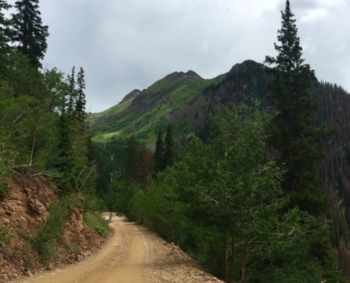 https://oneofsevenproject.com/wp-content/uploads/2020/03/Untitled-design-49.jpg
857
1493
Craig Fowler
http://oneofsevenproject.com/wp-content/uploads/2017/01/1of7-logo-lockup-grey-1132x212-300x56.png
Craig Fowler2020-03-26 19:58:502024-09-10 18:48:11CTR Gear: What Worked Well and What’s Even Better
https://oneofsevenproject.com/wp-content/uploads/2020/03/Untitled-design-49.jpg
857
1493
Craig Fowler
http://oneofsevenproject.com/wp-content/uploads/2017/01/1of7-logo-lockup-grey-1132x212-300x56.png
Craig Fowler2020-03-26 19:58:502024-09-10 18:48:11CTR Gear: What Worked Well and What’s Even Better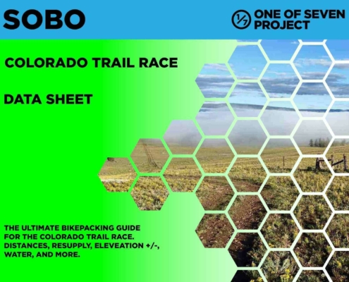 https://oneofsevenproject.com/wp-content/uploads/2023/12/rsz_2024_ctr_ds_sb_10.jpg
1275
1650
Craig Fowler
http://oneofsevenproject.com/wp-content/uploads/2017/01/1of7-logo-lockup-grey-1132x212-300x56.png
Craig Fowler2020-03-06 20:01:362024-09-10 19:31:33Ultimate Colorado Trail Planning Aids: Resupply, Mileage, and More
https://oneofsevenproject.com/wp-content/uploads/2023/12/rsz_2024_ctr_ds_sb_10.jpg
1275
1650
Craig Fowler
http://oneofsevenproject.com/wp-content/uploads/2017/01/1of7-logo-lockup-grey-1132x212-300x56.png
Craig Fowler2020-03-06 20:01:362024-09-10 19:31:33Ultimate Colorado Trail Planning Aids: Resupply, Mileage, and More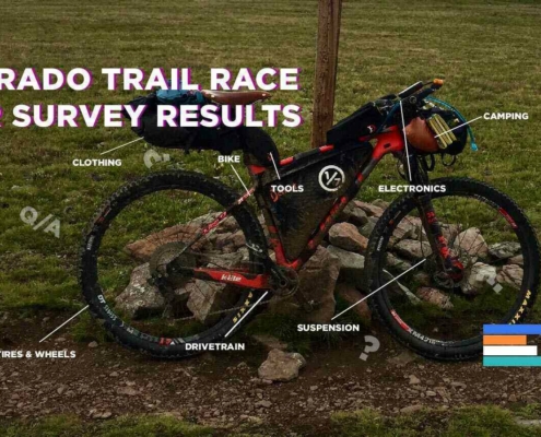 https://oneofsevenproject.com/wp-content/uploads/2019/11/rsz_ctr_sr_cover_2.jpg
857
1493
Craig Fowler
http://oneofsevenproject.com/wp-content/uploads/2017/01/1of7-logo-lockup-grey-1132x212-300x56.png
Craig Fowler2019-11-04 20:29:022024-08-06 13:18:46CTR Survey: Essential Gear Insights for New Riders
https://oneofsevenproject.com/wp-content/uploads/2019/11/rsz_ctr_sr_cover_2.jpg
857
1493
Craig Fowler
http://oneofsevenproject.com/wp-content/uploads/2017/01/1of7-logo-lockup-grey-1132x212-300x56.png
Craig Fowler2019-11-04 20:29:022024-08-06 13:18:46CTR Survey: Essential Gear Insights for New Riders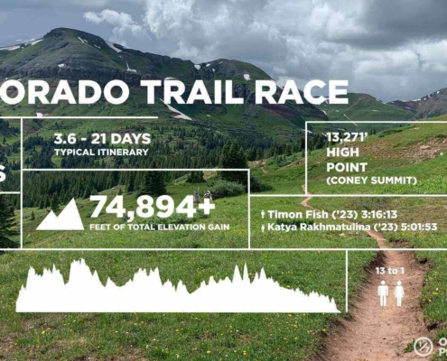 https://oneofsevenproject.com/wp-content/uploads/2021/03/CTR_Fact_Sheet-WEB.jpg
857
1493
Craig Fowler
http://oneofsevenproject.com/wp-content/uploads/2017/01/1of7-logo-lockup-grey-1132x212-300x56.png
Craig Fowler2018-04-11 10:39:532024-09-10 12:49:01Colorado Trail Made Easy: Essential Step-by-Step Planning Guide
https://oneofsevenproject.com/wp-content/uploads/2021/03/CTR_Fact_Sheet-WEB.jpg
857
1493
Craig Fowler
http://oneofsevenproject.com/wp-content/uploads/2017/01/1of7-logo-lockup-grey-1132x212-300x56.png
Craig Fowler2018-04-11 10:39:532024-09-10 12:49:01Colorado Trail Made Easy: Essential Step-by-Step Planning Guide https://oneofsevenproject.com/wp-content/uploads/2018/04/rsz_img_1936.jpg
857
1493
Craig Fowler
http://oneofsevenproject.com/wp-content/uploads/2017/01/1of7-logo-lockup-grey-1132x212-300x56.png
Craig Fowler2018-04-11 10:37:482024-09-10 19:30:22Ultimate Colorado Trail Transportation Guide: Airports, Shuttles, and More
https://oneofsevenproject.com/wp-content/uploads/2018/04/rsz_img_1936.jpg
857
1493
Craig Fowler
http://oneofsevenproject.com/wp-content/uploads/2017/01/1of7-logo-lockup-grey-1132x212-300x56.png
Craig Fowler2018-04-11 10:37:482024-09-10 19:30:22Ultimate Colorado Trail Transportation Guide: Airports, Shuttles, and More https://oneofsevenproject.com/wp-content/uploads/2019/12/LC4-13.jpg
857
1493
Craig Fowler
http://oneofsevenproject.com/wp-content/uploads/2017/01/1of7-logo-lockup-grey-1132x212-300x56.png
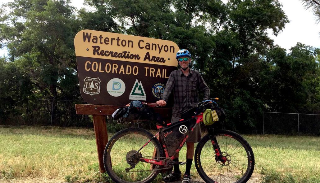
Craig Fowler2019-12-03 17:20:342020-10-28 09:40:19Colorado Trail Race Journal
https://oneofsevenproject.com/wp-content/uploads/2019/12/LC4-13.jpg
857
1493
Craig Fowler
http://oneofsevenproject.com/wp-content/uploads/2017/01/1of7-logo-lockup-grey-1132x212-300x56.png
Craig Fowler2019-12-03 17:20:342020-10-28 09:40:19Colorado Trail Race Journal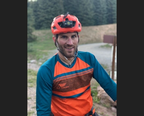 https://oneofsevenproject.com/wp-content/uploads/2019/10/LC4-3.jpg
857
1493
Craig Fowler
http://oneofsevenproject.com/wp-content/uploads/2017/01/1of7-logo-lockup-grey-1132x212-300x56.png
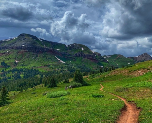
Craig Fowler2019-07-31 16:54:172020-03-07 12:02:12Faces of the CTR – 2019
https://oneofsevenproject.com/wp-content/uploads/2019/10/LC4-3.jpg
857
1493
Craig Fowler
http://oneofsevenproject.com/wp-content/uploads/2017/01/1of7-logo-lockup-grey-1132x212-300x56.png
Craig Fowler2019-07-31 16:54:172020-03-07 12:02:12Faces of the CTR – 2019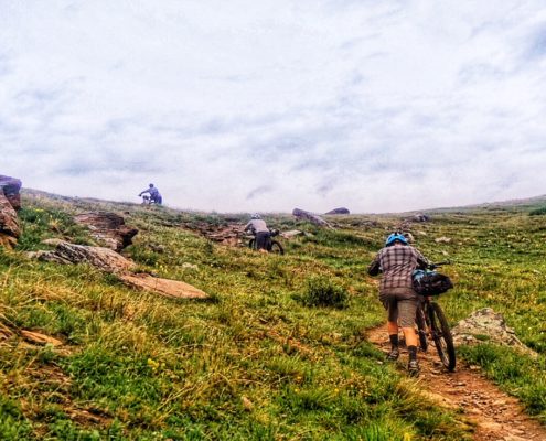 https://oneofsevenproject.com/wp-content/uploads/2018/04/IMG_5773.jpg
736
1280
Craig Fowler
http://oneofsevenproject.com/wp-content/uploads/2017/01/1of7-logo-lockup-grey-1132x212-300x56.png
Craig Fowler2018-04-11 10:35:442020-10-28 10:06:30COLORADO TRAIL HARDEST HABS
https://oneofsevenproject.com/wp-content/uploads/2018/04/IMG_5773.jpg
736
1280
Craig Fowler
http://oneofsevenproject.com/wp-content/uploads/2017/01/1of7-logo-lockup-grey-1132x212-300x56.png
Craig Fowler2018-04-11 10:35:442020-10-28 10:06:30COLORADO TRAIL HARDEST HABSThe Project conducts an ongoing rider survey to assist new riders in selecting the right gear for the Colorado Trail Race. Embarking on an adventure like the CTR can be daunting, and the planning process overwhelming. We hope this survey will aid new riders in their preparation and execution of their Colorado Trail ride, ensuring they are better equipped for their adventure.
If you haven’t taken the Colorado Trail Race Rider Survey yet, we encourage you to participate through the links below.
***Please pay close attention to the examples provided for questions requiring typed answers. If responses are not entered exactly as shown in the examples, I will need to correct them, which can skew the results. Thank you in advance!

Covers: bikes, suspension, tires & wheels, drivetrain, and Components.
Covers: navigation planning, camping, logistic/travel, clothes, and more.
Being that I’m also a Triple Crown thru-hiker I’m used to quality planning tools. After finishing the Bikepacking Triple Crown I realized bikepacking didn’t have quality planning tools available. The Project’s Planning Aids and Resources are our answer to this.
After 100’s of hours of research, 1000’s of keystrokes, more emails and phone calls than I can recall the One of Seven Project’s Colorado Trail Race Planning Aids are done. They’re the ultimate planning resources for the Colorado Trail Race. They contain everything you need to plan and execute your race/ride of the CTR. If you can’t find what you’re looking for in these then it’s probably in our Colorado Trail Resources.
IMPORTANT NOTES:


Click “Buy Now” button below to visit 1/7 Store with larger examples and more details.
One package including our two most popular planning aids.


Click “Buy Now” button below to visit 1/7 Store with larger examples and more details.
One package including all of our planning aids.
Available in both SOBO and NOBO versions and ONLY in US Standard units.
Small Bundle – $40.00 + tax (CO only) *You save $10 when you bundle!
Big Bundle – $60.00 + tax (CO only) *You save $20 when you bundle!


Gives you the most information of any planning aid.
Click “Buy Now” button below to visit 1/7 Store with larger examples and more details.


Similar to the Data Sheet, with slightly less information, but displayed showing cumulative mileage and elevation gain.
Click “Buy Now” button below to visit 1/7 Store with larger examples and more details.
All versions of the Town Lists are ONLY available as part of the Small or Big Bundles.
Available in both SOBO and NOBO versions and ONLY in US Standard units.
Data Sheet – $25 + Tax (CO only)


Click “Buy Now” button below to visit 1/7 Store with larger examples and more details.
Quickly find the total mileage between any two POI along the route.


Click “Buy Now” button below to visit 1/7 Store with larger examples and more details.
The Mileage and Elevation Gain Charts are ONLY available as part of the Big Bundle.
Big Bundle – $60.00 + tax (CO only) *You save $20 when you bundle!


Simply clicking on the links below with our affiliates supports the Project.


