DIFFICULTY (1-10)
8-9
Have you ever wondered what it would be like to hike the Pemi Loop?
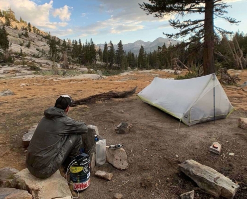
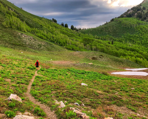
Many say the Pemigewasset Wilderness holds the best views in the entire White Mtns. This alone should make anyone want to go and explore the area. It’s also said to be one of the hardest one day hikes in New England (not that one has to do it in a day). The Project put together this online Pemi Loop guide and accompanying planning aids to help you complete the loop for yourself.
What follows is a version of The Project’s proven bikepacking guides. This Pemi Loop guide is meant to assist you in your planning but is not intended to be an all inclusive guide. The Project gives you the basics, supplies you with links to further resources (both on this site and elsewhere), and we have our planning aids for sale as well. It’s out belief that one should do their own homework for any trip, that way you have better first hand knowledge. It leaves one better educated for the task at hand and makes for a safer experience.
This Pemi Loop Guide focuses on the most popular loops in the Pemigewasset Wilderness, (Semi-Pemi West, Semi-Pemi East, Pemi Loop, Super Dupper Pemi, and Big Pemi). Of course you can do a variation of any of these as well.
Shopping with our affiliates helps fund the development of content like this.
8-9
JUNE TO OCT. (but year round hiking is possible.)
70.31 sq. acres (45,809 acres)
3-14 (depending on which loop.)
15
100+
2-3 Days (for standard Pemi-Loop)
The Pemi Loop is an 30 mile loop within the Pemigewasset Wilderness. With its 45,809 acres the Pemigewasset Wilderness also holds over 100 miles of trails, fourteen 4000 foot peaks, and multiple rivers and streams. The Projects Pemi Loop Guild will help you explore it all.
The Pemi as it’s called was designated wilderness in 1984 by congress. Before it was protected loggers almost harvested it’s entire forest cover for it’s lumber between 1890-1940. Today almost no signs of this can be found. Many of the old logging roads are used as trails today.
The Pemi Loop typically starts at the Lincoln Woods Trailhead (possible other starting points: Liberty Springs, Falling Waters, Old Bridal Path, Garfield Trail, and North Twin), makes its way up to Franconia Ridge via Osseo Tr., then follows Garfield Ridge to Twinway, next it traverses the Bonds via the Bondcliff Tr. looping back around to the Lincoln Woods Tr. completing the loop.
As the Pemi Loop has gained popularity of the years as one of the most beautiful and hardest (one day) hikes in the area, it attracts every type of hiker and runner looking for a challenge. Because of the wide range of users, many variations of the loop can be found online. The main ones today are the Semi Pemi (West and East), Pemi Loop, Super Duper Pemi, and the Big Pemi. As mentioned there are various versions of these main ones as well.
We made this Pemi Loop Guide to help navigate the different options.
Miles: 24.4
NH 4000’ers: 5
Elevation Gain: 6496′
Elevation Loss: 6348′
ROUTE
Lincoln Woods Tr.
Osseo Tr.
Franconia Ridge Tr.
Garfield Ridge Tr.
Franconia Brook Tr.
Lincoln Woods Tr.
Miles: 24.6
NH 4000’ers: 3 (7 if you do side trips to West Bond, Zealand Mtn., North Twin, and Galehead)
Elevation Gain: 4788′
Elevation Loss: 4777′
ROUTE
Lincoln Woods Tr.
Bondcliff Tr.
Twinway
Frost Tr.
Twinbrook Tr.
Franconia Brook Tr.
Lincoln Woods Tr.
Miles: 30
NH 4000’ers: 7 (12 if you add side trips to Mt. Garfield, Galehead, North Twin, Zealand Mtn., and West Bond)
Elevation Gain: 9208′
Elevation Loss: 9066′
ROUTE
Lincoln Woods Tr.
Osseo Tr.
Franconia Ridge Tr.
Garfield Ridge Tr.
Twinway
Bondcliff Tr.
Lincoln Woods Tr.
Miles: 44.9
NH 4000’ers: 13
Elevation Gain: 13792′
Elevation Loss: 13788′
ROUTE
Lincoln Woods Tr.
Osseo Tr.
Franconia Ridge Tr.
Garfield Ridge Tr.
Frost Tr. (out and back to Galehead Mtn.)
Twinway
North Twin Spur
North Twin Tr.
Fire Wardens Tr.
Lean-a-Hand Tr.
Twinway
Zealand Mtn. Summit Spur (out and back to Zealand Mtn. summit)
Bondcliff Tr.
West Bond Spur Tr. (out and back to West Bond summit)
Bondcliff Tr.
Lincoln Woods Tr.
Miles: 46.1
NH 4000’ers: 14
Elevation Gain: 16579′
Elevation Loss: 16578′
ROUTE
Lincoln Woods Tr.
Osseo Tr.
Franconia Ridge Tr. (U-turn to a previous saddle)
Bushwhack from saddle on Franconia Ridge to Lincoln Brook Tr.
Lincoln Brook Tr.
Owl’s Head Path.
Bushwhack from Owl’s Head summit to Lincoln Brook trail.
Franconia Brook Tr.
Garfield Ridge Tr. (out and back to Garfield Mtn. summit)
Frost Tr. (out and back to Galehead Mtn.)
Twinway
North Twin Spur
North Twin Tr.
Fire Wardens Tr.
Lean-a-Hand Tr.
Twinway
Zealand Mtn. Summit Spur (out and back to Zealand Mtn. summit)
Bondcliff Tr.
West Bond Spur Tr. (out and back to West Bond summit)
Bondcliff Tr.
Lincoln Woods Tr.
The Semi-Pemi West is the shortest of the loops and has about 1700 more feet of evelation gain and loss than the Semi-Pemi East. This loop is gernerally done in a clockwise fashion. Just like doing the East loop in a counter-clockwise fashion, doing the West loop in a clockwise gives you the ability to change your mind and do the whole Pemi loop if you choose. This loop is the only one that does not have the option of easily stopping a AMC hut.
Franconia Ridge is one, if not the best view in the entire White Mountains. This makes it a very popular destination, so expect the ridge portion of this loop to be the busiest. The Semi-Pemi West only offers one potential side trip to hit more 4000’ers, Mt. Garfield.
The extended above tree line hiking of the Franconia Ridge makes this hike not only difficult but also potentially dangerous. Be cautious of the weather as it can move in fast and being on the ridge and exposed is not where you want to be in a storm. This above tree line area is also very sensitive so be extra careful to stay on trail and avoid stepping on vegetation.
The Semi-Pemi East is the second shortest of the loops and also has the least amount of elevation gain/loss. Most people do the loop in a counter-clockwise fashion, choosing to experience the views of the Bonds early in their hike. Going this direction also give one the ability to change their mind and go for the full Pemi if they do choose.
The Semi-Pemi East has options to hike West Bond, Mt. Guyot, Mt. Zealand, North Twin and Galehead Mtn. One could even take the Garfield Ridge Tr. instead of the Frost/Twin Brook Trails and then summit Mt. Garfield, backtrack to Franconia Brook Tr. and take that south back to the loop.
The morning sunrise from along the ridge that makes up the Bonds, is said to be one of the best in the Whites. If you can, try to plan you hike so you can catch the sunrise.
The Pemi Loop is the original loop that started it all. It is now consider a must do for any avid hiker, and tooted one of the hardest one day hikes in New England. At 30 miles and around 9000′ of elevation gain/loss the Pemi Loop is sure to test any hiker (from those doing it in a day to those enjoying a 2-3 day hike).
We don’t dare say one direction is more popular than the other, but here at The Project, we prefer the clockwise direction. Both directions offer incredible views of the Pemigewasset Wilderness. The climb up the Bonds is slightly longer and has less vertical gain but the climb up the Osseo Tr. to Mt. Flume is said to be one of easiest climbs up a 4ooo’er there is.
One has the option of adding Mt. Garfield, Galehead Mtn, North Twin, Mt. Guyot (not on the AMC 4000′ list but it is a 4000′ peak), Zealand Mtn., and West Bond to their loop to make the number of 4000’ers go from 7 to 12.
The Super Duper Pemi includes all the potential 4000’ers that the Pemi Loop does not hit: Mt. Garfield, Galehead Mtn, North Twin, Mt. Guyot (not on the AMC 4000′ list but it is a 4000′ peak), Zealand Mtn., and West Bond. It also includes Mt. Hale as well. This brings the total to 13 AMC 4000’ers. One achieves these 13 peaks by hiking a 42 mile loop with just under 14,000′ of elevation gain/loss.
The Super Duper route leaves the classic Pemi Loop at South Twin, making a clockwise loop that heads to North Twin, then to Mt. Hale, over to Zeacliff, to Zealand Mtn. and back to the Pemi Loop at the junction of Bondcliff and Twinway. These extra 13 miles add almost 5000′ of elevation gain.
This loop also offers hikers a second AMC hut (Zealand Hut) to visit or stay at, more incredible views from Zeacliff, and time in the woods! The Super Duper Pemi only misses one AMC 4000’er, Ow’s Head. To hit that you need to do the Big Pemi.
The Big Pemi Loop is the one loop to contain them all. By contain we mean includes all 14 of the AMC 4000’ers that are within the Pemigewasset Wilderness. At almost 50 miles and over 16k of elevation gain and loss, this loop is a monster. Some ambitious souls do this in 24 hours but the average hiker should expect it to take 3-5 days.
Like with all the Pemi Loops you could start the Big Pemi at any number of locations. Each location will add mileage and elevation gain/loss to an already hard loop. Besides big mileage and vert, the Big Pemi includes two bushwhacks (the first from Franconia Ridge down the Lincoln Slide to Lincoln Brook Tr. and the other north off Owl’s Head to Lincoln Brook Tr.) and one abandon trail (Fire Wardens Trail up Mt. Hale). These three sections only add to the loops difficultly.
The Big Pemi is not for everyone and one should be confident in their ability to travel not only big distances but also have the ability to navigate off trail. If you have doubts, then start with one of the other Pemi loops.
PERMITS / REGULATIONS
No permits are required to hike in the Pemigewasset Wilderness. There are the follow backcountry regulations in effect:
— Group size is limited to no more than 10 people per party.
— Do not store equipment, personal property, or supplies (caching) in the Wilderness (including geocaching and letterboxing).
— As with all designated wilderness areas, mechanical transportation (including wagons, game carts, and other vehicles) is prohibited.
Campfires are prohibited at the following locations (except at designated sites):
1. within 200 feet of any trail
2. within 200 feet of the East Branch of the Pemigewasset River from the wilderness boundary to its crossing with the Thoreau Falls Trails (including islands)
3. where trees are 8’ tall or less (except when there is 2 or more feet of snow)
4. within 1/4 mile of Thoreau Falls
5. within 1/4 mile of any hut, shelter, cabin, picnic area, developed campsite, or developed day use site
OVERNIGHT VISITORS
— Overnight visitors cannot occupy any single location longer than 14 days in a 30-day period.
Camping is prohibited at the following locations (except at designated sites):
1. within 200 feet of the East Branch of the Pemigewasset River from the wilderness boundary to its crossing with the Thoreau Falls Trails (including islands)
2. where trees are 8’ tall or less (except when there is 2 or more feet of snow)
3. within 1/4 mile of Thoreau Falls
4. within 1/4 mile of any hut, shelter, cabin, picnic area, or developed day use site
CAMPING
All established campsites: Thirteen Falls Tentsite, Franconia Brook Tentsite, Goyut Campsite, Garfield Ridge Campsite, Galehead Hut and Zealand Hut all charge to stay there. Tentsites and campsites are $15, huts are over $100, see the AMC website for more.
Like with parking, space at campsites is limited and is first come, first serve. If you show up late (even during the week), chances are the site will be full. If so, find the caretaker for suggestions of where to sleep.
PARKING
Not all but some parking lots charge a fee. Checkout the forest service website for more.
Due to the areas popularity, parking lots fill up fast. Get there early, have a back up plan, and remember to only park where it’s allowed.
DANGERS & PITFALLS
MAPS / BOOKS / APPS
Read these next.
Gear lists from the AT, PCT and CDT; Pros & Cons; Things I’d do different; and Tips.
Cool threads and more!
Throwing out of bounds sucks!
Celebrate your thru-hiking class with the Class of ___ T-shirt!
It’s June. Ride, Eat, Sleep, Repeat Arizona Trail Race.
Checkout all our available products in our store, and thanks for the support!
Simply clicking on the links below with our affiliates supports the Project.
Or checkout our Deals page to save big!