Colorado Trail Journal

The Colorado Trail (CT) is a 486.4 mile long multi use trail that extends from southwest Denver to Durango, CO. The CT is part of the Mini Triple Crown. For most it’s a one month or more long trip and averages over 10,000′ in elevation. There are no shortage of views. What follows is my Colorado Trail Journal.

Like most of my journals this Colorado Trail Journal is a glorified blow by blow of my days on trail. I told myself I was going to talk more about how I felt mentally and what emotions I was feeling but I realized those things are mine and I didn’t share them. Hopefully you’ll still find my adventure worthy of reading and that it might inspire you to get out and follow your own passion.

You can checkout my gear list here.

Hike Data

486.4 miles (2.1 off trail miles)
Waterton Canyon TH (Denver) to Junction Creek TH (Durango)
August 18th 1:00 pm to September 8th 10:39 am
20 days 21 hours 39 minutes (w/ one zero day)
Average daily mileage: 23.3
Average daily mileage (w/o zero day): 24.5
Longest day:  27.9
Shortest day:  9.4
Elevation +/-:  89,032 / 87,538

Day 1

Day 1 – 8/18/2021

Waterton Canyon TH to Mile 17.5

17.5, Total 17.5

3100’ up, 2020’ down

1 pm to 8:15 pm

Mostly Sunning 90

Days Camped Alone: 1


Critter Count:

5 Big Horn Sheep

1 Grey Squirrel

1 Chipmunk

1 Deer (Fawn)


Today was like most first days I went pretty hard in the beginning even though I told myself to take it easy. Luckily the trail starts with a 6 mile dirt road walk at maybe 1 to 2% grade, so it wasn’t too hard on my body (just my feet). The fact that it was shadeless was the worst part.

As usual it’s going to take me a few days to really settle in and let go of the rat race of every day life. Whatever I stopped I constantly felt like I should be moving. When I finally stopped for dinner I kept looking reasons why I didn’t like the spot and was tempted to move on. Finally I just said Scatman you’re sitting right there and cooking, so I did. After a few minutes of sitting I definitely felt a lot better. I need to just listen to myself.

I keep thinking that I have to put in the miles, forgetting that if I just spend a little bit of money, I can always push out my flight on the other end a few days. I tried to take in as much as I could, I did see some critters and some birds. I believe I saw a Woodhouse’s Scrub-Jay, hummingbird, Chickadees, and a Robin, and a  Hairy Woodpecker, as well as a few others I can’t think of at the moment.

I was only going to do 13.8 but the campsite was exposed on the ground was very hard (and we all know I’m like Goldilocks when it comes to camp spots). So naturally, I pushed onto the South Fork of the Platte River and I got water. I was going to camp right there and of course I looked a little bit and I saw no camping signs. So I was forced to moved on for about a mile and I’m now on a ridge at the top of some switchbacks and the edge of a large burn area.  

The process of setting up of my tent was horrific to watch, and I didn’t do a good job of getting on the flat a spot, so night one is going to be subpar as far as my standards go. Unfortunately, this spot isn’t much softer than the one I passed up earlier.

To sum up the day it was one where: I fretted about my deadline, something I’ve never had before on a hike. I was over eager to push the pace, and I was acting like a hypochondriac with every little pain or bit of soreness.

Visually the days was nice. The walk through Waterton Canyon was nice for a bit but got old quick. Once off the the road the trail got into the trees and views were hard to come by. When you did have one you saw distant hills of rock and trees. They looked like something out of an old western. Due to the late storms I was treated to some good colors at sunset.

I’m pretty spent so I’m just gonna stop now and get some sleep.

Day 2

Day 2 – 8/19/2021 

MILE  17.5 – Mile 43.4

25.9, Total 43.4

5100’ up, 2400’ down

5:45 am to 5:45 pm

Mostly Sunning 60-70, showers

Days of Rain: 1

Days Camped Alone: 1


Critter Count

8 Deer

4 Chipmunks

1 Grey Squirrel

1 Black Squirrel

1 Rabbit

Western Tanager


I didn’t sleep well due to the temperature and the hard surface. I’m sure being tired and sore didn’t help. I had set the alarm for 5 am but it was pitch dark so I might have to adjust that. 

There was a small sprinkle at some ungodly hour this morning while I was still in bed. 

The miles came easy today but behind my left knee there is a dull pain. It’s almost as if my hamstring is tight. Oddly it doesn’t hurt all the time. I hope it goes away as I go. The other two ailments is tight shoulders and chaffing from the family jewels rubbing my inner thighs. This last one hurts the most. 

I went further than I needed due to the easy miles. But I couldn’t see stopping at 4:30 in the afternoon. Since I pushed on I’m camping with two other SOBO hikers. HEED (Matt from Virginia) and 5 Star (Jim from Montana). We ended our day with a one mile climb. We’re camped about half way up the current climb.

I did get rained on today but it wasn’t bad enough for my rain jacket. I had two thunderstorms pass me as well. No lightening but lots of thunder. 

Today I saw many more trail users than I did on day one. I saw 4 bikepackers and another 3-5 other MTBs, and some hikers and one runner. One thing I did see that I was pretty excited about was a black squirrel and some Western Tanagers, (see listed above for a full critter list).

This section of trail had amazing forest of pines and at other times aspens. The tread was like that of the JMT, in that it was mostly decomposing granite. Every once in a while I’d hit a spot where a bunch of pine needles got washed into a low area, and the tread was like walking on air. It was so soft on the feet.

As I walked I thought back to 2017 when I raced through this section of trail on my last day of the CTR. It was a beautiful area to hike through, but I still wished I was on a bike. I told all the bikepackers I saw I was jealous of them.

Day 3

Day 3 – 8/20/2021 

Mile 43.4 to Mile 65.8

22.4, Total 65.8

3300’ up, 2950’ down

6:31 am to 5:08 pm

Mostly Sunning 60-70, 

Days of Rain: 1

Days Camped Alone: 1


Critter Count

4 Chipmunks

4 Squirrel

Clarks Nuthatch

Gray Jay


I woke up at 12:13 am to pee and when I went back to try and sleep, I was starving. I ended up munching on Flaming Hot Cheetos to drive away my rumbling stomach.

It rained a bit around 2 am and all I could think is, “Please stop, I don’t want to hike in the rain!”

Due to the wetness of my tent my hands were quite cold to start my hike, which was up hill for 4.1 miles. I hit my high point so far on the trip, 10656’. This hike up the side of the mountain was through a dense pine forest. In a way it reminded me of New England but without all the moss. The tread was rocky and quite filled with roots.

From the high point it was all down hill to a beautiful 6 mile long meadow which sat at 10k feet. The hike through the meadow was amazing. I shared the first bit with some young kids, but when one of them rolled her ankle I kept going (after I was sure she was alright).

The meadow was a stead climb to another high point, where the trail enter back into the pines. From there it was mostly downhill for a long while. There was one look out with a view of the 10 Mile Range, which I would be going over in a few short days.

Today was not as hard as yesterday by any means, but it was pretty windy so I wore my wind jacket a lot throughout the day. 

I’m still debating if I want to try and keep my schedule. It’s felling a bit aggressive and I’m not sure it’s going to be that enjoyable. That said I did hike 22.4 miles by 5:10pm. Then again it was an easy day. The big mountain days are going to be harder and slower. 

I meet 4-6 other thru-hikers today. In total I saw about 15-20 ppl. 

Day 4

Day 4 – 8/21/2021 

Mile 65.8 to Mile 87.5, (10623’)

21.7, Total 87.5

4100’ up, 3100’ down

6:30 am to 6:53 pm

Mostly Sunning 60’s / rain / hail / thunderstorms

Days of Rain: 2

Days Camped Alone: 2


Critter Count

4 Squirrel

2 Chipmunks


I left my cleaning sponge outside my tent on a log and a critter stole it in the night! I had to get a new one in Jefferson when I got my resupply box. I told myself if was not wise to leave it there but I did anyways.

During the night I heard a pack of coyotes howling back toward where we had gotten water last night. There was also a great horned owl off in the distance. Then as we woke up around 5:30 am the old starting calling again. I really love hearing owls hoot.

I slept pretty good I didn’t have to get up during the night to go to the bathroom. I was on a bit of an angle falling to my right side, but I managed. The day started with fairly smooth and easy hiking. It didn’t take very long at all to get to Kenosha Pass.

As I approached the pass I saw my first trail magic. There was a small Rubbermaid storage box next to a sign. As I approached I could see there was goodies inside. Once to the box I saw it was a bag of peanuts in their shells, some sort of dirt mix, and a bunch of Starburst candy. I reached for the Starburst and when I picked up a few of the candies, I found they were all wet and water logged. Sticky juice from the Starburst got all over my fingers and hands. I tossed them back into the box and proceeded to attempt to wash my hands. I was greatly disappointed.

Once to the pass it took me at least 35 minutes to catch a ride trying to hitch. I even had a sign which another hiker (who I actually met on the morning of day 2) gave me that said “Jefferson” on it. Just as I got a hitch a girl who I saw yesterday, who is also going to town just walked up to the road, and got a ride with me.

Once in town I had about 2 1/2 hours to kill before the post office opened. So I had a burrito smothered with green chili and a Mountain Dew for breakfast. It looked amazing but it wasn’t that great. I eat most of it but just wasn’t feeling it.

We hung out until noon, when I got my box and I quickly went through my resupply. I also bought a new sponge, nail clippers because my nails are growing like crazy, and during all this I charged my phone. It didn’t take us long to find another ride back to the pass.

Once back to the pass I hit the trail around 12:45 pm, which was much faster than I expect. I stopped at the campground to dump my trash from my packs secret pocket as I forgot to in town and hit the pooh shed.

I totally did not remember the trail as it was from the CTR. I had completely forgotten about at least two climbs between Kenosha and Georgia pass and so much more. In my mind it was just going to be all uphill from the Kenosha Pass to Georgia Pass.

I stopped at Jefferson Creek for water and it was the most beautiful little creek I had seen so far. It was wide and swallow, and the way it flowed through the area was just picturesque. While at the creek I met two bikepackers for what would turn out to be the first many times over the course of the day and the next few.

As I started up Georgia Pass I heard some thunder but I kept going cause it was behind me. Then as I got closer to tree line it started to come from in front of me. Finally it started to hail a little, then quickly turn to rain. I ducked for cover under a group of trees for about five or 10 minutes and then the sun came out. I figured this was my window to make it to the top before the next storm rolled in.

When I got going another storm looked like it was coming up from the other side, so I worked harder than I have all hike, and also at the highest elevation I’ve been on the whole hike. Despite these factors I double timed it to the top. As I did I started to catch the two bikepackers.

The storm never hit but when I g0t to the top, the two bikers were taking pictures in my direction. When I got to them I turned around, and there was the most incredible incredible rainbow. It was a full end to end one at that. We all marveled at it for a bit, then I got going so I could get back into the trees and get to a lower elevation before camping.

My plan was the camp maybe just over the top but with multiple storms in the area and it being pretty chilly I did not want to camp at 11,700’. It turned out a thru-hiker named sunrise was already camped there anyways. I pushed on and the goal was to make it a mile 87.5 but when I got there I wasn’t impressed and it was quite windy so I kept moving. As usual I kept going further and further until finally, I actually found a really great spot.

I just got the tent set up before a sprinkle was about to get me wet. I cooked, cleaned, brushed my teeth, and because there was supposedly  a bear in the area last week, just a few miles lower than me at the next river, I put up a bunch of branches up to make it hard for him to get at my tent without making noise. I have never done this in my life but this bear sounds like he’s quite determined. I’m also camping by myself tonight, so I figured it couldn’t hurt.

Overall the day way good. The tread was great and the hiking wasn’t that hard. Going up Georgia Pass wasn’t very hard, just long and drawn out. The possibility of getting really rained on and having to deal with some thunder storms diffidently soured my mood for a bit but in the end I barely got wet.

That’s it for tonight I’m out. 

Day 5

Day 5 – 8/22/2021 

Mile 87.5 to 111.2 (11578’)

23.7, Total 111.2

4800’ up, 4100’ down

6:27 am to 6:15 pm

Mostly Sunning 60-70’s

Days of Rain: 2

Days Camped Alone: 3


Critter Count

4 Squirrel

3 Pikas

2 Deer

1 Chipmunks


Once again I didn’t hear my alarm go off even though I took my watch off my wrist and held it in my hand next to my face. Because I didn’t hear it, I slept in later than usual.

Unfortunately I did not sleep well once again I just don’t think that my aging body can take the foam pads anymore. I wake up about every half hour to roll over because my side hip and shoulder would be in pain. The campsite looked like it was going to be really nice too, which was a bummer.

I did 17 miles by noon today! Despite the fast pace, I still got to enjoy this section of trail. I’ve done it now about 4 times, but it’s such a pretty section I didn’t mind.

My fast pace allowed me to catch up with Heed who was ahead of me since I went into Jefferson and he didn’t. He was at the bus stop, headed into Breckenridge to resupply and take a zero. I texted him a few miles out from the road and he told me if I hurried I could catch the bus with him. I made it with about three minutes to spare.

We took the bus into downtown and then walked to a local pizza place. The pizza was okay by my standards, but I also didn’t have a big appetite either. We ate and chatted, then I headed back to the trail and him to the hostel. The whole trip cost me about two hours but I still was able to put in the allotted miles for the day that I had planned for. 

For some reason I didn’t drink or eat much today. My stomach was a little bit crazy just like it was yesterday but not as bad. I just didn’t feel like eating. The lack of calories was evident in my slow climbing and my mood. While I was waiting for my dinner to cook I called my folks and I was super down and depressed. 

After I finished my dinner and had some much needed calories in my system, my mood improved greatly and I gave my folks another call to let them know that I was in better spirits. I do think that I need to make a change on how I’m tackling this trail. Maybe take a zero day when I see Justin on Wednesday.

Tomorrow is going to be a big day with a climb right out of the gate over the 10 mile ridge, and a very long push up and over Searle Pass and Kokomo pass. I feel like if I can get through tomorrow I can then really reevaluate how I’m doing as I tackle the Holy Cross and Desolation wilderness areas.

I met Highlight and Brew Hiker today, who I know from Instagram. I hungout with them for a bit while they finished a break, then hiked together for a bit. I caught them again later in the afternoon, then I left them down the hill, from where I’m camping for the night. The camping wasn’t up to my expectations, so I moved on from where we all had stopped.

Today and yesterday afternoon offered me my first real views that moved me. The mountains surrounding the Breckenridge area are big in comparison to anything I have seen so far. I’m excited because it means I’ll start seeing more Pikas and Marmots!

Despite the lack of appetite and feeling down, today was a great day. I really enjoyed the hiking and the forests I hiked through. Stopping in town was a nice treat too. I did really pay for the lack of calories at the end of the day. Luckily, once I at I was a changed person and could appreciate what I had done and seen, instead of question why I was doing what I was doing.

Day 6

Day 6 – 8/23/2021 

Mile 111.2 to 137.3  (9674’)

26.1, Total 137.3

4800’ up, 6500’ down

5:53 am to 6:30 pm

Mostly Sunning 60-70’s, Rain 

Days of Rain: 3

Days Camped Alone: 4


Critter Count:

12 Marmots 

8 Pikas

5 Squirrel

3 Chipmunks

1 Deer (buck)

1 Mouse


Despite not being perfectly flat while sleeping last night and feeling like I woke up every time I rolled over I felt pretty good this morning.

I got going just before 6 o’clock and I was treated with an amazing sunrise over the mountains I had just come from the day before. The climb right out of the gate was quite hard and put me in the red zone right away. It took longer to get over 10 mile Ridge then I remembered. 

I did get to see some pikas and my first marmot of the trip!

The descent from the ridge was windy, pretty chilly, and of course quite steep. I felt my thighs more on 10 mile than I did coming off of Kokomo at the end of the day.

When I got to Copper Mountain resort I went to Starbucks got myself a second breakfast and charged my phone and my battery pack a little. I just got there before the first rain shower of the day hit. My timing was perfect.

With my phone at 90% charged, I made my way back to the trail and force myself to take it easy and not rush up the climb. The going was slow and at one point the clouds rolled in and the skies let loose. It wasn’t heavy rain but it lasted for about 20-30 minutes and I just sat under a tree waiting for it to stop.

Once it stopped I started again and made my final push up and over Searle Pass. Despite the sun being quite bright, I decided to have lunch at the top of the pass. I should’ve taken more time but I was afraid I was going to get a sunburn. I made my way to Kokomo Pass and was reminded just how long it is between the two passes.

It was my fourth time over both of those passes, two hiking and two times riding. The descent from Kokomo Pass is almost 6 miles long, and a thigh burner. After being exposed to the intense sun for so long between the two passes, I kept waiting for the trail to just stay in the trees but it didn’t. Like most days by the end of the day I’m feeling sunburned, but usually is a combination of both sun and the wind.

The sun’s intensity increases from 4-8% for every 1000′ you climb in elevation. For me, the sun is one of the most draining parts of hiking in Colorado. I don’t recall the JMT being as bad.

I totally missed the campsite that I had picked out on Guthook and walked right by it. I had plenty of time so I continue to Camp Hale where I cleaned up and got water at a creek and then had dinner just inside the trees. I took my time as it was still quite early by my standards.

After dinner and cleaning up, I pushed on .9 miles to a campsite I saw in Guthook. I thought the campsite was far enough make it so I did a marathon, but it turned out to be .1 miles short! There was still plenty of daylight left and I could’ve kept going but I already put plenty of miles in and I decided to give my feet a break. My feet were quite tired after today.

The two bikepackers I met at Jefferson Creek three days ago went pasted not long after I got into my tent. I thought their tires tearing at the dirt was a bear, thank God it was just the two of them.

We had a conversation for a bit, but a guy I saw on a bike just before I reached Searle Pass came up behind them. I was surprised because this third biker was going NOBO when I saw him. This means he rode over Kokomo to Searle Pass, then down to Copper Mtn. Resort, then turned around and came all the way back. I don’t know where he started, but it was a huge day on the bike!

As I was lying here going through my photos from today, something hit the top of my tent. It came from my left, hit the ridge of the tent then kept going off to my right.  All I can guess is that it was a bird. I just can’t figure out why it hit my tent.

Day 7

Day 7 – 8/24/2021

Mile 137.3 to 164.1 (10956’)

26.8, Total 164.1

5560’ up, 4200’ down

5:57 am to 5:50 pm

Mostly Sunning 70’s

Days of Rain: 3

Days Camped Alone: 5


Critter Count:

6 Chipmunks

4 Squirrel


I slept OK last night, still not the best night sleep. I got up with the alarm after one snooze it was still dark when I started. I’m starting to think that I’m gonna set my alarm later, so I start later and I also finish my days later. Lately I’ve been stopping at around six and it just seems weird to sit around for 2+ hours for it to get dark so I can fall asleep.

It was pretty chilly first thing in the morning, that made me think that I should get some tights because it’s only going to get colder as I go. It was cold enough that the meadow I went through had frost all over the grass.

I will say I was bored while hiking the section before Tennessee Pass. When I finally got to the pass I didn’t feel like I had accomplished much, even though I had. It was a weird feeling.

The day went by pretty quick as the terrain was not that difficult compared to previous days. The Holy Cross Wilderness was quite beautiful and so was the first part of the Mount Massive Wilderness as well. You could tell the old growth of the wilderness areas versus the non-wilderness areas. 

The Holy Cross Wilderness area offered great views of high cliffs and the ridge line that ran through the wilderness. Looking up at the ridge made me want to come back and hike up on to of it.

At lunch I had cell phone reception and I called Justin to let him know that I was going to take a day off. He’s picking me up at noon tomorrow at Twin Lakes. I’m still really battling with the concept of slowing down, taking breaks and not always being in a rush. I would have thought after a week I would have settled into a grove. The reality is I have, it just doesn’t involve me taking long breaks, going slow, or doing short mileage.

I found myself wondering what I was trying to prove or if I was since I’ve already hiked this section and biked it, I kind of feel like “Why am I doing this again?”. Then I think about what my dad is going through at home alone with my mom and it makes me really sad. We talked right before I wrote this and I got really emotional like right now I’m crying because I wish I was there.

So far this hike has been much more mentally tough than others. Maybe that’s true or it just seems like it’s harder. I don’t know. I do know that I miss my mom and my heart goes out to her and my dad as they try to deal with her losing her memory. The next two weeks are going to be really hard on the mind.

Day 8

Day 8 – 8/25/2021 

Mile 164.1 to 177.5 Hwy. 82

13.4, Total 177.5

5560’ up, 4200’ down

5:59 am to 10:30 am

Mostly Sunning 70-80’s

Day’s of Rain: 3

Day Camped Alone: 5


Critter Count:

4 Squirrels

3 Chipmunks

1 Deer


Last night as I wrote in my daily journal entry I heard something large come up through the area where the nearby stream was. I listened to it a bit and as I attempted to get out of my tent to see what it was, it ran off up the mountain. I’m pretty sure it was a moose. Whatever it was, it was big and breaking branches.

The rest of the night went pretty well and I slept okay. Waking up knowing I only had 13.4 miles to hike was a good feeling. I got going and the miles came easy. Since I was in the trees there wasn’t many views to distract or slow me down.

I caught and pass another hiker then as I ate my breakfast at the Mount Massive TH, he caught me and passed me back. Once I was done with my breakfast I got going again and quickly came upon the same hiker. He was checking his map to ensure he was going the correct way at an intersection. I assure him he was going the correct way.

As we chatted I found out he was attempting to hike the trail in 15 days. It was his first thru-hike as well. I also found out he ran out of food and only had about 50 calories left. I had extra food since I was going faster than planned and gave him about 200 calories of extra food.

Justin, the fellow hiker, not the Justin picking me up, and I hiked the rest of the way to Twin Lakes together. We had a great time chatting each other up. When we got to the subject of bikes he knew the exact bike that I’m getting. He was actually going to order one himself but at the last minute changed his mind.

Justin and I got to Hwy. 82 in no time, as we were flying. We made the 1.2 mile road walk to the general store and promptly took seats in the shade outside. Food and drinks were next, but to our disappointment, the food truck that serves burgers was closed on Wednesdays! I got snacks in the store, but Justin went with frozen burritos from the other food truck.

My Justin, the one picking me up, showed up around 1 pm and we gave thru-hiker Justin a ride back to the trail where we left off. We promptly head back to Carbondale, stopping in Aspen for burgers. We made a few stops to drop off some kits for some of Justin’s clients before heading to Carbondale.

Once to Carbondale I did laundry, organized my gear and relaxed. My buddy Dave cooked one of his amazing meals and I enjoyed my first home cooked meal in over a week.

Day 9

Day 9 – 8/26/2021 

0 Day

0.0, Total 177.5

0’ up, 0’ down

am to am

Mostly Sunning 70-80’s

Day’s of Rain: 3

Day Camped Alone: 5

Zero Days: 1


I slept great in Dave’s spare bed. Before I even went to bed I made a plan to eat at all my favorite spots in town. For breakfast I had a fruit smoothie and a sausage egg, and cheese breakfast sandwich. Lunch was pizza at my favorite pizza place, Peppinos. They finally had some chocolate chip cookies too. I bought three packages for the trail.

The rest of the day I ran errands and relaxed. I couldn’t find any tights or sleep socks. For the most part it was a typically zero day. Rest, food, and more rest.

Dave did cook another amazing meal and his parents joined us this time.

Day 10

Day 10 – 8/27/2021

Mile 177.5 to 202.7 (11245’)

25.2, Total 202.7

5840’ up, 4000’ down

7:45 am to 7:10 pm

Mostly Sunning 70-80’s

Days of Rain: 3

Days Camped Alone: 6

Zero Days: 1


Critter Count:

6 Chipmunks

4 Squirrels

1 Bunny


After taking yesterday’s zero, I kind of had mixed emotions about starting again. Originally, I really wanted to start and just finish, but starting again there was a part of me that was just like, “Meh…”. My emotions were super confused at this point with my mind fixed on my mom.

The day started at 5:30 am. Justin was picking me up at 5:45 am so we could make the one hour and forty minute drive back over Independence Pass and back to the trail. We had to leave so early so Justin could then drive all the way back and still get to work on time. We were both pretty quiet and tired on the drive over. The most excitement was seeing a group of big horn sheep on the way down the pass.

As expected it took forever to go around Twin Lake. Also my memory of what the section was like, was nothing like I remembered from 2017. There was a lot more climbing than I remembered and a lot more exposure to the sun. It was quite hot today and I sweated a ton.

As I walked through one of the meadows I came across a portable pooh seat. One of those set ups where it’s just a toilet seat attached to folding criss cross legs. There was even a full package of wet wipes. It’s like someone knew I was c0ming! Unfortunately I didn’t have to go at the time.

When I got to Clear Creek I had lunch along the shore before the day’s second climb. The second climb of the day was a monster. It almost topped out at 12,000’ (4.7 miles long, total grade was 588.4 feet/mile, with 2738.8 feet of climbing). I definitely had to keep stopping even though I was going at a very slow pace. Or should I say what I thought was a slow pace.

Once over the top, I dropped back down to Pine Creek.  The views along the way of the Collegiate Peaks were amazing. This is a section of trail that I have not seen before, so I was pretty interested to see what it was like. I can say that this downhill did not disappoint and neither did the one later in the day.

When I got to the bottom of the long descent at Pine Creek I had a decision to make. The decision was multifaceted. The first part was that there was a very large climb in front of me just like the one I had just gone up. My options were to just stay there, or I could continue up the next climb. If I stayed low there was a good chance there would be condensation on my tent in the am. If I went up the climb there was a chance I wouldn’t find another flat spot as the camping options were limited and so was water.

With it being fairly early still, I made the decision to push over the climb and I got water on the downhill at Morrison Creek and cooked dinner. It got pretty chilly during dinner because I sun had dropped behind the ridge.

I saw what looked like potential flat spots about 1.7 miles from my dinner spot and I decided to push on to there. I was hoping that I would have cell service, because I really wanted to talk to my mom and let her know that I really miss her. Unfortunately there’s no service where I’m at, a small arm of the mountain in front of me is blocking the signal from Buena Vista.

I also have my first virgin campsite which I don’t think anyone has slept at before, so I’m really hoping that it’s comfortable.

Day 11

Day 11 – 8/28/2021

Mile 202.7 to 228.9 (8594’)

26.2, Total 228.9

4500’ up, 7100’ down

6:27 am to 7:39 pm

Mostly Sunning 70-80’s

Days of Rain: 3

Days Camped Alone: 7

Zero Days: 1


Critter Count:

11 Chipmunks

4 Squirrels

1 Bunny


So today I slept in till 6 o’clock to see if it helped me finish my day later. I’ve been getting all my miles in by like 4 o’clock and then I can’t sit still because there’s still four hours of light left. I toil with doing too much or sitting around feeling like I’m not doing enough.

Today I had one and a half tough climbs. The first one was the biggest one and it was like 2500 feet up and averaged over 700 feet per mile.

The kicker today was the heat and the amount of sunshine coming through the canopy. It was definitely one of the warmer days in a while.

I took a nice break at lunch at Cottonwood Creek and got to watch what I’m guessing we’re some brook trout having their own lunch.  Some of them were jumping out of the water making a little splashes, it was really fun to watch them in their natural habitat.

My plan was to stay at a place called Dry Creek when I got there as usual it was only around 4:30 pm. I should’ve just stayed there because the map showed that the rest of the way was sidehill and the possibility of finding a good flat spot was pretty slim.

Of course I moved on and the map didn’t lie but what it didn’t show is that there was some private land. Then there was a youth camp with more private land, then pavement and fences on the side of the road and even less chances to camp.

I ended up cooking on the porch of a little building that was part of the youth camp that was supposed to be a stage coach stop. The nicest part of it was that I got to eat my dinner sitting in a chair with a back.

After finishing dinner I debated on just going inside the building which wasn’t locked and sleeping on the floor, but there appeared to be a significant amount of mice activity.  I moved on, hopeful that I would find a flat spot at the area that I saw on the map that might work. Unfortunately the Goldilocks in me did not like any of the spots that I found so I continued on now I’m under a couple small trees on the bend of a road and on a climb. All I can hope is that the cars don’t run all night.

Today was a classic Scatman. I should’ve just sat right where I was and said this is it this is camp when at Dry Creek. Instead I pushed on and rolled the dice, but as we all know the house always wins, or in this case the trail. To those hikers who say, “The trail provides.” It provided, but it was the bare minimum. 

Day 12

Day 12 – 8/29/2021

Mile 228.9 to 256.3 (9586’)

27.4, Total 256.3 (+ .9)

5200’ up, 3800’ down

6:27 am to 7:10 pm

Mostly Sunning 70-80’s

Day’s of Rain: 4

Day Camped Alone: 8

Zero Days: 1


Critter Count:

7 Chipmunks

5 Squirrels

5 Deer


I paid for last nights indecision to not camp in the woods. The car traffic up the hill was bad until about 10 o’clock and then it died down significantly and I was able to sleep. It was only a few cars that came by in the very early hours of the morning.

I was up and going around 6:30 am and it was only 2 miles to Mount Princeton Hot Springs. When I got there I found out the store didn’t open till 9 am in the dining hall not till 8 am. I did not want to wait for either one of them, as I knew that I could most likely reach the Monarch RV park and my resupply box if I didn’t.

I charge my phone a bit as I repacked my bag and organized what food I had left to make sure I had enough without going to the store and I moved on. It was another 3 to 4 miles of road walking out of town and then a significant climb. It was hot but not as hot as yesterday and I made good time.

As the afternoon wore on I started to slow down and started to feel the effects of the miles and the heat. After lunch there was a few rain showers but they were more like sprinkles than rain showers. I met some bikepackers who were doing the Vapor Trail 125 at the bottom of my last big climb before I reached Highway 50.

I made my way to Highway 50 which seem to take forever like every destination does when you’re hiking into a trail town. I decided to walk the .9 miles down Highway 50 to the RV park even though all the notes suggested you should just hitch. It wasn’t bad until I got to an area with a guard rail and no shoulder. At that point I was forced to walk on the roadway and it was a bit sketchy.

At the RV park I got a Coke and checked in to see if there was any cabins available, and the cost for tenting. There was no cabins and it was 20 bucks to put up my tent. I wasn’t going to pay $20 to put up my tent to listen to Highway traffic go past all night.

I organize my box called a local trail angel for a ride back to the trail head. I also called and talk to my folks briefly. When I left I took with me my largest load yet,  4.25 days of food and headed back to the trail.

Once back to the trail I had a 3 to 4 mile dirt road walk which was of course uphill. I don’t remember this 3 to 4 miles at all for my bike race, as well as many other areas that I walk today.

I found myself a nice unused spot to throw down on some soft duff in a stand of tall skinny pines. There were some other hikers or campers just back from me but I decided to camp on my own where the ground was softer.

Day 13

Day 13 – 8/30/2021

Mile 256.3to 283.4 (11601’)

27.1, Total 283.4 (+ .9)

6000’ up, 4000’ down

6:27 am to 6:53 pm

Mostly Sunning 70-80’s

Days of Rain: 4

Days Camped Alone: 9

Zero Days: 1


Critter Count:

15 Chipmunks

13 Elk

5 Squirrels

5 Pikas

4 Deer


I slept pretty good last night though my spot wasn’t as soft as I thought it was going to be. I woke up right before my alarm but then I still hit the snooze once. Even with that I still got out of camp in 19 minutes and somehow I managed to get out of camp at exact same time as the day before, 6:27 AM.

The day started with a 6 mile climb, then even some more climbing, then some even bigger descents and finally more climbing. The end of the day was on what I would consider the worst tread of the entire trail which is going down off of Windy Mountain to Tank Seven. The area is frequented by dirt bikes, so the trail is very ripped up and is filled with very sharp rocks. Makes walking quite difficult the footing is unstable and you can’t keep a normal stride ever. The descent is also incredibly steep. I almost fell on the way down and I still can’t believe I didn’t.

Shocker, I pushed on further than I planned on to today. I had the option of a 6 mile carry with 3 L of water to a dry camp or pushing on.  Originally I opted for the water carry but after only .25 miles I said “FUCK IT”. I wasn’t going to go that far for dry camp. I dumped most of the water I had and then tackled that really rocky station I just spoke of above.

Once to Tank Seven, I took a short break talking to another hiker and then I had a 4 mile climb up to a cattle take just below the summit of Sergeant Mesa. Big news today, I saw my first elk of the trip. A large herd was just off the trail on the way up Sargents Mesa. I got to see a few of them running away through the woods. I also heard the bull bugling.

I was hoping that the small saddle on the other side of the mesa would offer some flat camping options, unfortunately it was open in fields which would have be dewy in the am. I found myself a small spot just off the trail as I descended. It’s a bit lumpy and I’m at 11,600 feet so I’m worried about two things, one that I won’t sleep well on the lobby ground (my back was hurting all day from the heavy pack), two that I will be cold at this elevation.

I currently have about 203 miles left to hike over the next nine days. Tomorrow is going to be a roller coaster of more rocks and tough going, but the day after that should be pretty good. I just hope the weather that I’ve been hearing about doesn’t head my way.

Despite my back hurting, I was happy with today’s hike. I made good miles even though I took multiple breaks and tried to take my time not rushing. Monarch Crest was spectacular as always. 

Day 14

Day 14 – 8/31/2021

Mile 283.4 to 306.9 (10261’)

23.5, Total 306.9 (+ .9)

3600’ up, 5000’ down

6:37 am to 4:30 pm

Mostly Sunning 70-80’s

Days of Rain: 4

Days Camped Alone: 10

Zero Days: 1


Critter Count:

14 Chipmunks

5 Squirrels

2 Pikas

2 Deer

1 Snake


Last night was not as cold as I thought it would be. The ground was lumpy, though it wasn’t the best sleep, but it wasn’t the worst either.

I tried to take my time getting going but once I started packing, it’s like I just go into berserker mode and I just speed up (I think the chill in the air had a little to do with it but it was mostly my mindset). Then when I hit the trail, I had to keep reminding myself not to hike so fast right out of the gate, and to slow down and ease into it. I don’t think I did a good job though.

I passed six hikers right away and the one bikepacker I saw late last night. Shortly after I saw five more hikers. Two were going southbound and the other three northbound. I would pass one more northbound or section hiking just before Razor Creek. The bikepacker caught me at the creek and we had a good chat. It’s his third time doing the Colorado trail and he said probably as last.

The two Sobo‘s also caught me at Razor Creek and we sat and talked a while I didn’t get the young lady‘s name but the gentleman‘s name is Michael and his trail name Peacock. 

I moved on for the next water source, not realizing it was after the roller coaster of hills I had been dreading. I thought it was much closer to me and not so close to Highway 114. So when I got to the last of the large roller coasters and saw where I was, I couldn’t believe how far I already gone. The miles just flew by.

I called my dad from the top of that last peak and chatted with him a bit. But the whole time I felt like I had to get off the phone to save battery life when I still have tons of juice left in my external battery. It’s just so weird how the mind works out here. Now that I don’t have service here tonight I wish I had another chance to talk to him.

I moved on, tackled one last climb and descended to a dirt road which I then took to Highway 114. I stopped and got water on the way and then I stopped for lunch. Just before lunch a red pick up went by and then while I was having lunch he came back by. He had picked up the young lady from Razor Creek. She was taking a zero day.

During lunch Peacock showed up and sat down and had some food with me. We had a great chat and then left together for the highway. Once to the highway we saw two other hikers finishing a section waiting for their ride.

We moved on and hit the next water where there was a garter snake at the edge. I got to watch him explore between the rocks and under the rocks looking for things to eat. It was really cool to watch him meticulously look at each little nook and cranny for food.

Peacock and I moved on down the trail and I dumped my water for some colder stuff. I carried 3 L the rest of the way to where camp is tonight. I got here around 4:30 pm and there were two gentleman here in their 70s who have been doing hikes together since about 1976 or 78, and I’ve only missed doing it two or three times during all that whole time. It was very cool to hear their stories and see their bond.

Peacock and I had a great time talking to them but both of them and peacock moved on further south. I did a bunch of housekeeping cooked dinner and looked at the schedule ahead.

The issue I have right now is I am only 40 miles from the last safe place to camp before Snow Mesa. Snow Mesa is an area that is open an expose in notorious for having bad weather. People have been struck by lightning many times in this area, so you do not want to cross it when the weather is bad.

My issue is that I’ve been averaging over 23 miles a day, so the next two days I only have to hike 40 miles. I’m going to have to try really hard to slow myself down and really take my time or I’m gonna have a really long time in camp the next two nights. The tough part is I only did 23 today which is three more than that I need to do and that was by 4:30. I’m going to have to try really hard to slow myself down.

What’s so tough about this is is that I know I can do bigger miles, and there’s a chance that I could get across Snow Mesa in an afternoon and I wouldn’t have any issues. Or all hell could break loose, you just don’t know. The weather is supposed to be shit on Thursday when I would hit it, but it it’s not I might just go balls to the wall go for it. All I can do is hike the miles and see what happens when I get there. That said, I am thinking and adjusting my decision on crossing the mesa a lot.

Day 15

Day 15 – 9/1/2021

Mile 306.9 334.8 (10822’)

27.9, Total 334.8 (+ .9)

3700’ up, 2600’ down

6:35 am to 6:30 pm

60’s Mostly Cloudy, then Rain off and on

Days of Rain: 5

Days Camped Alone: 10

Zero Days: 1


Critter Count:

8 Chipmunks

8 Squirrels

4 Deer

3 Prongies


I slept pretty good last night. 

Got a good start and tried to keep the pace slow. I did pretty good at the pace setting until Thomas caught and passed me. Thomas is a bikePacker who showed up late at camp last night. He’s also the brother of Shawn who was the bikepacker I saw earlier in the day yesterday. (This is Thomas’s 4th time riding route).

Once Thomas speed away downhill I picked up the pace along the endless dirt roads and Jeep track. 

I got the idea that if I caught Peacock who I met yesterday, I could team up with him to get over Snow Mesa. I did catch him and it was much earlier than expected. We hiked together for a while then I went ahead. 

I also met and passed Jack, a Canadian, who is thru-hiking. I had lunch at the Cochetopa Creek and Jack passed me, then Peacock joined me. We hiked together again, then I went ahead and passed Jack as it started to rain. It was the first time all trip I actually put on my rain jacket. Unfortunately you could tell the rain was going to stay around a while, so my moon quickly sank.

I took a break at a trailhead just as the rained stopped, chatted with some overnight hikers and Jack passed me once again. Peacock joined me once again for a snack. Then he and I hiked on as it started to rain again until we caught Jack. Peacock hiked on and I camped with jack. I was still trying to limit my miles to get over Snow Mesa in the morning hours.

The rain stopped again just before we reached Jack. It would come and go while I cooked and did my camp chores. My tent is on an angle and is sloping downhill. Being in a valley and next to a creek I already have condensation inside my tent. I’ll be drying things out tomorrow for sure. 

For the first time all trip I washed socks at lunch, now both pairs are wet because they didn’t dry due to the afternoon rain. Since it was the first real rain storm of the trip I got down, but kept reminding myself that everything is temporary.

I’m now only 23 miles to Spring Creek Pass. This means a crazy short day or going over Snow Mesa in the afternoon. I honestly don’t know what I’ll do tomorrow.

The first part of the day included a lot of dirt roads that made for boring hiking but the Cochetopa Creek valley is beautiful, even in the rain.

Day 16

Day 16 – 9/2/2021

Mile 334.8 to 357.8 (8663’)

23.0, Total 357.8 (+ .9)

5500’ up, 5300’ down

6:37 am to 4:08 pm

60’s Mostly Cloudy, then Rain off and on

Days of Rain: 6

Days Camped Alone: 10

Zero Days: 1

Hostel: 1


Critter Count:

35 Pikas

17 Chipmunks

15 Marmots

14 Deer

3 Moose


Today was the most spectacularly visual day of the trip so far. I took more photos today than the last three days combined. Right from the start it was beautiful. The morning sunrise started it all off. Then the day was filled with endless mountain view’s. 

The day started damp and cold but the hiking was great. I saw three moose at one time. They were three cows. As the day went on I saw tongs of pikas, marmot, deer, and hawks. The one thing that wasn’t good was the amount of beetle kill. I’d say close to 80% of the trees were dead from beetle kill. I don’t remember it being this bad in 2015 during my CDT thru-hike.

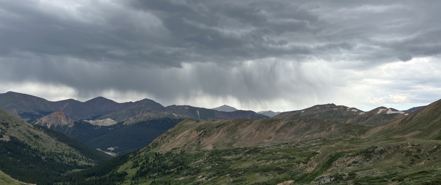
The weather was best described as moody today. I had wind, rain, cold, sun, and some hail. The views were just so incredible, that the weather didn’t really matter.

The day included multiple passes but none of them seemed too hard. My mind and eyes were so delighted by the views, nothing else really mattered. I did put my air buds in for the first time all trip. It was more that I wanted additional input, rather than I needed motivation. Not sure if that makes sense but it does to me.

When I got to the spot I had first planned on staying it was only lunch time and the weather didn’t seem to threatening. With this in mind I made the choice to tackle Snow Mesa in the afternoon. I passed a few hikers on my crossing and there was a bout of rain/hail but nothing more. The mesa was longer that I recalled but again the views were over the top!

What was exciting about today is not only the views but you could just feel the difference of the landscape. You just knew you were on the doorstep of the San Juans. Everything about the landscape changed. It felt bigger, was more rugged, the views and surrounding peaks more defined.

It took me about 30 minutes to get a hitch to Lake City. A nice older couple picked me up. They were on vacation looking for locations for future hikes. They dropped me off right in town. I made my way to the Raven’s Rest Hostel where I showered, did laundry, and then got some dinner.

For dinner I wanted some pizza as I hadn’t had any in over a week. I went to one place that was supposed to have it and when I looked at the menu in the window the only item crossed off was the 14′ hand tossed pizza. I backtracked to a bar I saw and thought I’d try there. As I went in I met a local who informed me their pizza wasn’t that good. We enter the bar and the entire bar turned to look at us, just like in the movies.

Once in the bar the local goes up to a buddy right in front of the bartender and says “Where else in town can you get pizza. The pizza here is crap!” The bartender just quietly listened to their conversation. They went back and forth and finally the local I met tells me the pizza was just frozen pizza. He says it was Red Barron!

I eat Red Barron at home enough, I wasn’t going to spend $12+ on a $3 pizza I make at home! I went back to the first place and had a $23 burger and fries. It wasn’t worth $23 bucks.

Only 6 days to go! 128.6 miles to go!

Day 17

Day 17 – 9/3/2021

Mile 357.8 to 367.2 (12073’)

9.4, Total 367.2 (+ .9)

2100’ up, 1000’ down

1:35 pm to 4:55 pm

50- 60’s Mostly Cloudy, then Rain and some hail

Days of Rain: 7

Days of Hail: 3

Days Camped Alone: 10

Zero Days: 1

Hostel: 1


NO CRITTERS


I didn’t sleep well last night. I’m not sure why though. I got up at 2 am to pee and then just wasn’t tired. That said, I got up at 7:30 and felt okay. 

I got breakfast at The Lake City Cafe. Then went to the post office to get my resupply box. Once back to the hostel I repacked my bag then wander town. The hostel was closed from 10-12 for cleaning each day and I wasn’t planning on hitting the trail until around 1 pm, so I had time to kill. I sat in the shade and made phone calls, then had lunch, and finally hitched to the trail. 

At the trailhead I saw three bikepackers and multiple hikers all going to the same place I was. With this knowledge I got hiking right away. I knew the camp spot had limited options for flat spots. As I hiked I passed even more hikers. Just before reaching the area I wanted to camp at, it started to rain/hail and the temperature dropped.

As I got water just past the old yurt location, my hands were freezing. I started to worry it was going to be a very cold night. I pushed on because the notes about camping spots were confusing and I thought I’d find another spot further up the saddle from the yurt. I ended up in an open area with sporadically placed trees. It’s a bit breezy and cold already, so it going to be cold tonight. With that said I’m super happy with the spot. It’s quiet and has a great view.

Chuck, who I shared the room with at the hostel joined me for the night. We talked and shared stories as we cooked our dinners.

Throughout my hike today the storm clouds were amazing. They looked frightening and full of evil. Luckily I was speared their wrath and only experience the one small squall. The views were even better than yesterday. Today I got my first look at the San Juans. The San Juan’s are full of  cliffs, ridges, mountains and long valleys. Once again I took a ton of photos!

5 days to go!  119.2 miles to go!

Day 18

Day 18 – 9/4/2021

Mile 367.2 to 394.9 (12557’)

27.7, Total 394.9 (+ .9)

6100’ up, 5500’ down

6:35 pm to 6:30 pm

60’s Most Sunny and wind

Days of Rain: 7

Days of Hail: 3

Days Camped Alone: 11

Zero Days: 1

Hostel: 1


Critter Count:

67 Pikas

53 Marmots

24 Chipmunks

1 Fox


I woke up at 2 AM to pee, when I get back to bed I could not sleep. It was like I was wide awake the rest of the night. Finally morning came and it was time to start my day.

I didn’t feel exhausted when I woke up but it’s weird that I couldn’t sleep again. Tonight I’m even higher than I was last night so I’ll see if I can sleep tonight. Tonight is the highest I’ve ever slept on this trip.

Today’s sunrise was beautiful and I got some great photos. The climb up to Carson Saddle and the high point of the Colorado Trail took forever. I forgot how many ups and downs they were between myself and the actual high point. 

I heard elk bugling as I made my way to the high point it was really cool to hear them.

The descent from the high point was as steep as I remember, I can’t believe that I pushed my fully loaded bike up that during the Colorado Trail Race.

In the a.m. I saw tons of pikas and quite a few marmots then as the afternoon warmed up I saw less pikas and more marmots and chipmunks. Then after dinner time I started to see more pikas again. Pikas are sensitive to warm temperatures. Today was the biggest day yet for any animal and for the pikas. I even saw a fox when I was sitting just below Stoney Pass, he was very cool. You should’ve seen the pikas and the marmots that were in the area scatter when he came through.

Another highlight when it comes to animals was it I saw two golden eagles. They flew from my right to my left just below my line of sight, between the mountain that I was on and the next one which was quite close. It was pretty spectacular to see them sore by. 

The afternoon wasn’t too bad in terms of my energy levels. Only one time did I felt like I should’ve eaten more and that was just before lunch which is usual for me. I tried to take it easy on the climbs so that I wouldn’t burn myself out knowing that I had a big day ahead of me. 

While filtering water just before stony pass my dirty water bladder that I used injunction with my filter burst a seam. It’s essentially trash now. I was able to get a small Smart Water bottle from a woman that was doing a day loop, not too long after.

I didn’t really mean to camp as high as I am but it’s just the way it worked out. I could’ve kept going but it would’ve actually made me go higher, and the first opportunity to camp was nowhere in sight. After such a big day at elevation, I was happy to stop.

Day 19

Day 19 – 9/5/2021

Mile 394.9 to 421.6 (11900’)

26.7, Total 421.6 (+ 2.1)

4700’ up, 5300’ down

6:47 pm to 6:40 pm

60-70’s Sunny

Days of Rain: 7

Days of Hail: 3

Days Camped Alone: 12

Zero Days: 1

Hostel: 1


Critter Count:

12 Pikas

7 Chipmunks

2 Marmots

1 Deer


Last night was pretty cold but I don’t know if it was the coldest. It probably was due to the layers I had on I just didn’t feel this cold because I have the layers. I actually wore my socks to bed around 3 AM I put my puffy jacket on.

Unfortunately, just like the night before I woke up this time around midnight to pee, and was astonished that it was only 12:30 am. When I went back to sleep I was wide awake and of course I was also hungry.

Tonight I’m going to try to eat as late as possible. In hopes that I get further into the night before I have trouble sleeping due to hunger.

The day started cold and within a few miles I was to the CDT/CT cut off. At this point I would be walking virgin trail that I had never walked before. I lasted until I got to a little Molas Campground. At that point I had biked the rest of the way to Durango during my 2017 CTR.

I descent down to the Animas river was quite long but unbelievably beautiful. The mountains and side canyons gave my imagination endless possibilities of exploring explore side trips and what might be located there.

At the bottom I met a couple on their way out and they were waiting for the train to come by so they could get a photo. I waited as well and got a video of the train going from Durango to Silverton. It was pretty cool that the timing worked out and I caught it.

I started the 4 mile climb up to Molas Lake Campground with the idea that I stop over halfway up and eat lunch. When I started getting really hungry I realized I was only 3/10’s of a mile from the turn off, so I ate a few Skratch gummies and push on to get to the campground. 

At the campground I had a Coke and two frozen chicken chimichangas while I went through my food box, and dried out my tent and my sleeping bag from the condensation. It wasn’t the best lunch but it tasted damn good to my trail appetite. 

I left the campground around 2:45 pm and then made my way to Little Molas Lake where I called my dad and then called my friend Michele to coordinate her picking me up on Wednesday.

A little past 3 pm I started hiking once more. The views in this section are pretty spectacular, and  I in as much as I could knowing that this was almost the end. I pushed on about 8 miles before calling it a day. This will allow me to finish before noon time on Wednesday if I do two 25’s the next two days.

I’m really looking forward seeing this next section at a slower speed than on Phillip and with nicer weather. Michele told me it’s supposed to be warm and Sunny the next few days.

Beside today being an awesome day of hike with amazing scenery, the beetle kill from the previous section is gone. Not having to see dead trees where ever you looked, really added to the beauty of the day.  

Day 20

Day 20 – 9/6/2021

Mile 421.6 to 446.1 (10885’)

24.5, Total 446.1 (+ 2.1)

4200’ up, 5500’ down

6:37 am to 5:45 pm

60-70’s Sunny

Days of Rain: 7

Days of Hail: 3

Days Camped Alone: 13

Zero Days: 1

Hostel: 1


Critter Count:

20 Pikas

7 Chipmunks

7 Squirrels

5 Marmots

2 Deer

1 Martin


Last nights camping spot turned out to be pretty good. Despite a stiff breeze once in a while, the little bowl that I was lying in cradled me nicely. I did have the problem that I woke up again and had trouble falling to sleep after going the bathroom.

I woke up refreshed but I still can’t understand why I’m not sleeping through the night. The sunrise was pretty special coming over The San Juan mountains. Not only was it pretty, but it brought with it much needed warmth. It was another cold morning.

I made it to my first pass quite fast. As a result I descended into the next valley and lost the little warmth the sun provided. As a result I spent most of my morning in the shade and was cold longer than any morning yet.

The area I was going through in the morning I had ridden through in the pitch black with my headlamp and generator light on Philip during the 2017 CTR. It was really interesting to see what I had ridding through and what I had missed.

Clearly I had missed a lot riding this at night and forgot a lot too. The morning was filled with views, side hills and multiple climbs. Visually it was another spectacular day.

Has the day wore on, I saw multiple mountain bikers out for day trips, and one motorcycle rider. I also saw a ton of PCT refugees hiking NOBO. Since the California section of the PCT is closed, many of the thru-hikers traveled over to Colorado to hike northbound on the CT.

Black Hawk Pass was pretty cool to go over again and the views were amazing. I had cell signal and I spoke to my folks real quick and then I moved on. Water was tight and I’m currently 4 miles into a 14 mile stretch without water. I should be okay because in the morning when I finish the last 10 miles it will be cooler and I don’t drink as much.

I really wish though I had drank more during the day because I don’t feel like I had enough. Now it’s too late at night to drink too much, because if I do I’ll have to pee multiple times and I hate getting out of the tent.

I met a gentleman on a duel sport today, and it just reinforce that I really want to get one myself before too long. What better way to cover ground and see new places in the back country.

I have a great campsite to myself on ridge.  It’s protected so there’s minimal wind and I should have good morning light come morning.

While killing time in camp and making phone calls I had a pine marten come through camp. I never expected to see one during my hike so I was super excited when I saw him. He was a dark chestnut and black it was loping along through the woods just outside my camp edge.

Visually today was amazing! I took a ton of photos. You see so much during the day, it’s so hard to capture it all.

Day 21

Day 21 – 9/7/2021

Mile 446.1 to 472.9 (9075’)

26.8, Total 472.9 (+ 2.1)

4200’ up, 6000’ down

6:47 am to 5:53 pm

70’s Sunny

Days of Rain: 7

Days of Hail: 3

Days Camped Alone: 13

Zero Days: 1

Hostel: 1


Critter Count:

14 Chipmunks

7 Pikas

5 Squirrels

2 Deer

1 Marmots


Last night I slept pretty well. I still woke up in the middle of the night and was wide awake. Luckily, I was able to get back to sleep. 

The sunrise was another spectacular one. I actually changed my morning routine so I could get some pictures of it. I actually stopped my packing mid way through, took photos then finished packing. 

When I started the day, I told myself I would take it slow so I wouldn’t hike too far or fast but then I remembered I didn’t have any sunscreen and there was an exposed section with lots of sun later in the day. I didn’t want to burn so I hiked at a pretty fast pace most of the morning and into the afternoon.  It was all for not, as I did eventually yogi some sunscreen off a couple PCT Refugees. 

I made great time getting to Indian Ridge, where I pushed on to have lunch at Taylor Lake. The views along the way were nothing short of amazing. I saw lots of birds of prey soaring on the heat currents. Despite being well ahead of schedule, I keep today’s pace high. I was feeling the pull of the finish.

I was blown away at how rocky Indian Ridge was and that I biked it in 2017. The ridge before the exposed section was full of beautiful trees and amazing soft tread.  Overall, today was another day where I took tons of photos and couldn’t possibly take in all the beauty around me. I’m blown away at the beauty of this section.

The descent from Kennebec Pass and multiple rock gardens along Indian Ridge beat up my feet, but they’ve been taking a beating for days now. I could feel the last three weeks of hiking in each step.

The original camp spot I choose was hard and rocky, and it was much too early to stop for the day, so I pushed on. Pushing on meant carrying 3L of water to camp, as it was dry.  I’m spending my last night with a family from Minnesota.  The daughter is thru-hiking and mom and dad are riding fat bikes (from Molas Pass to DGO). It’s not the best spot but one last night won’t kill me.

My back is pretty sore tonight. As I said earlier, I’m feeling the effort of hiking all these miles. That said, I won’t change it for anything. As I sat in camp I could feel myself accepting the fact that I had done it. I only have 13 miles left when I get up. Knowing I complete another trail, and did it how I had planned felt so satisfying.  

Day 22

Day 22 – 9/8/2021

Mile 472.9 to 486.4 (9075’)

13.5, Total 486.4 (+ 2.1)

1200’ up, 3200’ down

6:29am to 10:39 sm

70’s Sunny

Days of Rain: 7

Days of Hail: 3

Days Camped Alone: 13

Zero Days: 1

Hostel: 1


Critter Count:

3 Chipmunks

2 Squirrels

2 Snakes


Despite the hard ground and it being my last night on trail I slept okay. I was up and going in no time. From the moment I took my first step today, I felt the pull of the finish at Junction Creek Trailhead. I was a man on a mission.

I only stopped three times. Once to poop and the other two to chat with other hikers. I was surprised by the amount of climbing I had to do. When you look at the profile it looks like it’s all down hill. In 2017 I did this whole section in the dark so, none of it was familiar to me.

Since I didn’t recognize the trail, I thought the end was much closer than it was. I kept thinking I was almost there but wasn’t. Finally I recognized where I was and nothing was stopping me.

It felt good to finish! Michele was there to pick me up and as usual it was anti-climatic. No mental fireworks, tears of joy, or sadness. I simply had hiked from Denver to Durango. The one thing I felt was the sense of weight coming off me. The fact I had accomplished something I wanted to do, that felt great. I could now check the Colorado Trail off my list and move on to the next adventure.

Final Thoughts

Overall, the CT was an amazing trip. The mental aspect of it was tough. Wanting to be home to help my dad with my mom made it harder than it should have been. Despite this I was able to enjoy the 486.4 miles. The weather was as good as one could hope for. The trail was in great condition. I met some amazing people and soaked in more views than I can remember.

The CT might be shorter than its big brothers, but the beauty is on par with them. If you want to experience the wilds of CO, go hike the CT or a section of it. Hands down my favorite section was from San Luis to the southern Trailhead.

Final Critter Count:

Pika 159
Chipmunk 157
Marmot 88
Pine Squirrels 70
Deer 47
Elk 13
Big Horn Sheep 5
Snake 3
Rabbit 3
Moose 3
Pronghorn 3
Grey Squirrel 2
Pine Martin 1
Fox 1
Mouse 1
Black Squirrel 1

MORE RESOURCES

Read these next or checkout the main resource page.

Gear lists from the AT, PCT and CDT; Pros & Cons; Things I’d do different; and Tips.

Colorado Trail San Juans
CT, CTR, Colorado Trail, mountains, weather
JOHN MUIR TRAIL-DATA-COLLAGES - HIKING- THRU-HIKING
Long Trail Guide