PCT vs. CDT
In an earlier post I compared the Appalachian Trail vs. Pacific Crest Trail, (AT vs. PCT). That post is one of my most popular gets tons of traffic so I decided to do a comparison of the Pacific Crest Trail vs. Continental Divide Trail, (PCT vs. CDT). Like the AT and PCT, you can’t really compare the PCT to the CDT (though many love to), or any of the three with the others for that matter. Each is their own beast and it takes a different approach to complete them. There is no one best way to hike any one trail. Don’t let anyone tell you otherwise.
In my opinion the CDT was the harder of the two. I might have joked while hiking the CDT that the PCT stood for Piece of Cake Trail, but the reality is both can be extreme.
The truth is everyone has a different experience while hiking. Many factors such as time of year, snow/water levels, general weather, fitness, directions of travel and more will effect which will be tougher. Below I broke down some of the most popular categories one might want to see the difference between.
Remember these are just my take on my experience. Your’s will be similar but different.


Save big and support The Project at the same time! Check out our Affiliate Deals page for exclusive offers on top brands. Every purchase fuels our mission to provide you with the best guides and resources for your adventures. Bookmark it now and shop smarter—deals update regularly!


 PCT Sierras
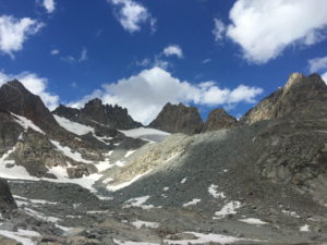


