As an affiliate partner, One of Seven Project earns a commission for purchases made through any product, brand logo links, or banner ads on this page. Thanks for your support!

One of the most popular questions I get asked is to compare the AT vs. PCT.
Comparing them is like comparing apples to oranges—they’re different in nearly every aspect. If you’re after a more comparable discussion, the PCT vs. CDT would make more sense.
No one can tell you which trail is right for you. Factors like your time, fitness, confidence, and weather conditions will all influence your decision. My advice? Research, prepare thoroughly, and know your ability level.
In my experience, the AT felt harder, but that was likely because it was my first thru-hike. Both trails can be equally challenging, depending on the year and conditions, but your experience will be shaped by factors like the time of year, snow levels, general weather, fitness, and direction of travel.
It used to be that the AT was the most common first thru-hike. However, with the advent of lighter gear, the PCT has become just as popular, with many now attempting it as their first thru-hike.
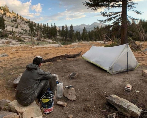
Below, I’ve broken down some popular categories to highlight the key differences between these trails. Keep in mind, these are based on my personal experiences—yours may differ. Keep reading to find out more as well as some tips for your own thru-hike and a look at my gear.
Shopping with our affiliates helps fund the development of content like this.


Appalachian Trail
The current unsupported thru-hike speed record was set by Joe McConaughy, who completed the AT in 45 days, 12 hours, and 15 minutes, averaging an astonishing 48 miles per day. For comparison, the average hiker covers about 15-20 miles a day.
Approximately 1 in 4 hikers who start the AT finish. Before 2006, the completion rate was closer to 10%. In 2014, 2,500 hikers began the trail northbound, and 653 completed it, resulting in a 26% completion rate.
Between 1936 and 1969, only 61 recorded completions were logged.
The trail crosses six national parks, eight national forests, and numerous state and local parks and forests.
Hikers take roughly 5 million steps to complete the entire trail.
Pacific Crest Trail
The current unsupported thru-hike speed record was set by Josh Perry in 2022, completing the PCT in 55 days, 16 hours, and 54 minutes, averaging 44 miles per day. Most hikers average about 20-25 miles per day.
The PCT passes the three deepest lakes in the U.S.:
Although the distance “as the crow flies” from Mexico to Canada is just over 1,000 miles, the PCT meanders at over 2.5 times that distance.
The trail passes through 33 federally mandated wilderness areas, 25 national forests, 7 national parks, and 3 national monuments. Along its route, the PCT crosses 57 major mountain passes, descends into 19 major canyons, and passes more than 1,000 lakes and tarns.
The PCT also traverses six of North America’s seven eco-zones, showcasing some of the continent’s most diverse landscapes.
APPALACHIAN TRAIL
The tread of the AT can be down right nasty at times. It’s often full of rocks or roots. That’s not to say it doesn’t have smooth parts too. The trail lacks switchbacks making the climbing quite difficult at times. The elevation gain/loss is almost 100,000′ more than the PCT.
PACIFIC CREST TRAIL
The PCT was designed and built so one could use pack animals on it. As a result the trail has a much easier grade and meanders up/around climbs. The actual tread is much smoother too. Don’t get me wrong, sections like the Alpine Wilderness in Washington State are rocky as rough on your feet as the tough AT sections.
APPALACHIAN TRAIL
Weather is never the same so it’s hard to say which has the better weather. The AT is wetter and much more humid. That said I hiked the whole state of Virginia with only a half hour of rain. Two years later I met a thru-hiker who never saw the sun for the 750 miles of Virginia. I got snow on April 1st on Roan High Knob.
PACIFIC CREST TRAIL
I personally found the weather on the PCT to be much better than the AT. The temperatures are higher on the PCT but it lacks the humidity of the AT. I’m reluctant to use the term “predictable” to describe the PCT’s weather. The PCT still has rain, hail, snow, lightening and more. Just know it can vary from year to year.
APPALACHIAN TRAIL
In my opinion navigating the AT is very easy. The white blazes are so predictably reliable compared to any other trails. Other trails use multiple types of signage making it confusing at times. If I hiked the AT again I wouldn’t even carry maps, I would only have the Farout App. The novice hiker that might be not feel as comfortable as me. Use your own judgement.
PACIFIC CREST TRAIL
When I hiked in 2007 map options were limited and not very good. Even so navigating wasn’t terrible. The PCT is marked well but not as consistent or as frequent as the AT. At times you have to follow your “Hiking Instinct” as I call it. Today there are many more map options and they are much better in quality. In my opinion if you have basic hiking skills and map reading ability you should do fine, but know your limits of course.
Official AT Guide Sets, Official AT Maps (they also have an app now too), and Postholer Maps,
PACIFIC CREST TRAIL
Halfmile’s Maps, PCTA Guide Books, Postholer Maps, John Muir Trail Map-Pack: Shaded Relief Topo Maps (Tom Harrison Maps)“Tom Harrison Maps for JMT (These were great to have in the Sierra.), US Forest Service Maps, and Farout App.
Links to “If I Hiked the…Again” Series:*
Appalachian Trail, Colorado Trail, Continental Divide Trail, Long Trail, and Pacific Crest Trail
*The “If I Hiked the…Again” series are a collection of gear lists that show what I would take if I went back and hiked a trail again.
Links to our Gear Lists:
Appalachian Trail, Pacific Crest Trail, Continental Divide Trail, John Muir Trail, and Colorado Trail
Pre-Hike:
On Trail:
APPALACHIAN TRAIL
Water is almost never an issue on the AT. Of the three trails it has the most sources available. Unlike the PCT or CDT water isn’t as high a priority on the AT.
PACIFIC CREST TRAIL
Water varies from year to year. Typically water is an issue up to the Sierras then in a few places in Oregon. Compared to the AT you’ll have to carry much more water on any given day. It will be or should be a main concern throughout your day.
APPALACHIAN TRAIL
Resupplying on the AT is by far the easiest of the three trails. You can resupply on average about every 3 days. Heck, if you plan right you can eat your way through the Shenandoah without carrying any food.
PACIFIC CREST TRAIL
My average resupply was between 4-5 days. The longest stretch being in the High Sierra from Kennedy Meadows to Independence, CA. There were less people on the more remote roads the PCT crossed than the populated east coast.
APPALACHIAN TRAIL
The AT has by far the largest trail community of the Big 3. There’s probably more resources for the AT than the PCT and CDT combined. The community surrounding the AT is vast and been in place for a long time. You will find plenty of off trail support.
PACIFIC CREST TRAIL
The PCT has strong hiking community due to its harsh environment. Trail Angels maintained water caches and offer rides to the trailhead on top of what you’d normally expect. Due to the vast growing interest in hiking the PCT from books and movies of late numbers have soared. 1500 attempted to thru-hike in 2015. These numbers have put a lot of stress on the community and some Trail Angels have had to close their doors. Be respectful when you stay with them and support them if you can.
*Note that every year these four items can be different as each effects the other. It’s never the same from one year to the next. Expect your experience to be your own and don’t try to compare it to others before you. Expect the unexpected.
AT |
PCT |
|
| Zero Days |
10 |
7 |
| Nights alone |
3 |
34 |
| Tarp Tent/Tent |
16 |
63 |
| Tarp |
0 |
7 |
| Friend’s house |
11 |
2 |
| Cowboy Camped |
0 |
34 |
| Motel |
11 |
10 |
| Hostel |
20 |
7 |
| Shelter |
94 |
1 |
| Rain |
35 |
12 |
| Snow |
4 |
1 |
AT |
PCT |
|
| 0 miles hiked |
10 |
7 |
| 1-4 miles hiked |
3 |
0 |
| 5-9 miles hiked |
17 |
6 |
| 10-14 miles hiked |
37 |
8 |
| 15-19 miles hiked |
63 |
21 |
| 20-24 miles hiked |
22 |
38 |
| 25-29 miles hiked |
1 |
25 |
| 30-34 miles hiked |
0 |
15 |
| 35-39 miles hiked |
0 |
4 |
AT – 2168
PCT – 2655
The above does not include side trails, town miles, or walking to from towns.
**Mileage has changed since I did the trail. To protect the trail it’s constantly being added to and moved to protected land.
AT – 153
PCT – 125*
*This does not include the 31 days on bike from Seattle to Mexico or the 4 days from Manning Park to Seattle. 160 total days.
AT – 15.2
PCT – 22.5*
The above does not including zero days.
*This does not include the 31 days on bike from Seattle to Mexico or the 4 days from Manning Park to Seattle. 160 total days.
AT – 3
PCT – 34*
*A couple were while on my bike, maybe 3.
AT – 7 days 99.5 miles (White Mountains,NH to Sugarloaf Mtn.in Maine)
PCT – 3 days 99.7 miles (just south of Snoqualmie Pass to Cathedral Rock, in the Alpine Lakes Wilderness)
AT – 32 days, 447.1 miles (Hanover,NH tom Baxter Peak; northern terminus of trail)
PCT – 42 days, 1032.7 miles (Enta, CA to Manning Park,BC; northern terminus of trail)
AT – 135.7
PCT – 200.1
AT – 26.3 miles (Winthuri Shelter in VT -Hanover,NH)
PCT – 36.1 miles (Jake Spring – Crater Lake Mazama CG)
Read these next or checkout the main resource page.
Gear lists from the AT, PCT and CDT; Pros & Cons; Things I’d do different; and Tips.
 https://oneofsevenproject.com/wp-content/uploads/2020/04/rsz_1untitled_design_83.jpg
857
1493
Craig Fowler
http://oneofsevenproject.com/wp-content/uploads/2017/01/1of7-logo-lockup-grey-1132x212-300x56.png
Craig Fowler2020-04-21 12:02:372024-06-20 09:17:19How to Pick the Perfect Campsite
https://oneofsevenproject.com/wp-content/uploads/2020/04/rsz_1untitled_design_83.jpg
857
1493
Craig Fowler
http://oneofsevenproject.com/wp-content/uploads/2017/01/1of7-logo-lockup-grey-1132x212-300x56.png
Craig Fowler2020-04-21 12:02:372024-06-20 09:17:19How to Pick the Perfect Campsite https://oneofsevenproject.com/wp-content/uploads/2019/12/LC4-23.jpg
857
1493
Craig Fowler
http://oneofsevenproject.com/wp-content/uploads/2017/01/1of7-logo-lockup-grey-1132x212-300x56.png
Craig Fowler2019-12-28 18:36:142024-06-20 13:20:24Top 5 Reasons Thru-Hikers Quit
https://oneofsevenproject.com/wp-content/uploads/2019/12/LC4-23.jpg
857
1493
Craig Fowler
http://oneofsevenproject.com/wp-content/uploads/2017/01/1of7-logo-lockup-grey-1132x212-300x56.png
Craig Fowler2019-12-28 18:36:142024-06-20 13:20:24Top 5 Reasons Thru-Hikers Quit https://oneofsevenproject.com/wp-content/uploads/2019/07/2019-2020-BIKEPACKING-CALENDAR-2.png
890
1335
Craig Fowler
http://oneofsevenproject.com/wp-content/uploads/2017/01/1of7-logo-lockup-grey-1132x212-300x56.png
Craig Fowler2019-07-02 12:41:322024-06-20 13:21:18Shakedown Hike
https://oneofsevenproject.com/wp-content/uploads/2019/07/2019-2020-BIKEPACKING-CALENDAR-2.png
890
1335
Craig Fowler
http://oneofsevenproject.com/wp-content/uploads/2017/01/1of7-logo-lockup-grey-1132x212-300x56.png
Craig Fowler2019-07-02 12:41:322024-06-20 13:21:18Shakedown Hike https://oneofsevenproject.com/wp-content/uploads/2019/02/rsz_img_0380.jpg
857
1493
Craig Fowler
http://oneofsevenproject.com/wp-content/uploads/2017/01/1of7-logo-lockup-grey-1132x212-300x56.png
Craig Fowler2019-02-10 16:18:032024-09-11 07:44:47Most Common Mistakes Thru-hikers Make
https://oneofsevenproject.com/wp-content/uploads/2019/02/rsz_img_0380.jpg
857
1493
Craig Fowler
http://oneofsevenproject.com/wp-content/uploads/2017/01/1of7-logo-lockup-grey-1132x212-300x56.png
Craig Fowler2019-02-10 16:18:032024-09-11 07:44:47Most Common Mistakes Thru-hikers Make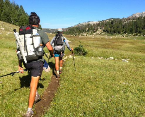 https://oneofsevenproject.com/wp-content/uploads/2019/01/Untitled-design-49.jpg
857
1493
Craig Fowler
http://oneofsevenproject.com/wp-content/uploads/2017/01/1of7-logo-lockup-grey-1132x212-300x56.png
Craig Fowler2019-01-04 19:25:492024-06-20 13:22:49Mental Side to Going Ultralight
https://oneofsevenproject.com/wp-content/uploads/2019/01/Untitled-design-49.jpg
857
1493
Craig Fowler
http://oneofsevenproject.com/wp-content/uploads/2017/01/1of7-logo-lockup-grey-1132x212-300x56.png
Craig Fowler2019-01-04 19:25:492024-06-20 13:22:49Mental Side to Going Ultralight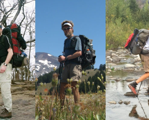 https://oneofsevenproject.com/wp-content/uploads/2012/06/Untitled-design-47.jpg
857
1493
Craig Fowler
http://oneofsevenproject.com/wp-content/uploads/2017/01/1of7-logo-lockup-grey-1132x212-300x56.png
Craig Fowler2012-06-07 18:34:512024-06-20 13:23:42Cutting Pack Weight
https://oneofsevenproject.com/wp-content/uploads/2012/06/Untitled-design-47.jpg
857
1493
Craig Fowler
http://oneofsevenproject.com/wp-content/uploads/2017/01/1of7-logo-lockup-grey-1132x212-300x56.png
Craig Fowler2012-06-07 18:34:512024-06-20 13:23:42Cutting Pack Weight


Simply clicking on the links below with our affiliates supports the Project.


