The LT was my second thru-hike and my first after doing the Appalachian Trail. It helped form my love for hiking and exploring. The LT is part of the Mini Triple Crown, which includes the Long Trail, John Muir Trail, and the Colorado Trail. What follow is my Long Trail Journal.
The Long Trail (LT) is a 272 mile foot path along the length of the Green Mountains in Vermont. It travels from the Massachusetts/Vermont state line to the US/Canadian border. The LT is the US’s original long distance trail, predating the Appalachian Trail. The two share 100 or so miles from the southern terminus to the Maine Junction, which is located just north of Rt. 4 Near Pico Mountain.
If you’ve read any of my other more recent journals you’ll note that the Long Trail Journal is quite different. This journal is the actual journal as I wrote it while on trail. There are many give-a-ways if you look for them. The entries are short. Grammer and sentence structure is terrible. It lakes details and its hard to follow at times.
It really shows you how tried I was at the end of each day and how my mind wasn’t working at 100%. Please enjoy it all the same.
Hike Data
272.2 miles
Ma/VT State Line to US/CAN Border
Sept. 8th – 11:15am to Sept. 25th – 9:26am
16 days 22 hours 11 minutes
Miles Per Day: 15.2
Day 1
Sept. 8th
13.8 – miles 13.8 total miles
MA/VT State line to Congdon Shelter
70 and Sunny
I didn’t sleep well last night. Most likely it was nerves. Dudley (my cat at the time) spent my last night with me. I had breakfast with my family then my dad, grandmother and I hit the road around 8 am. We got to the trail in Williamstown, MA around 11 am and I was on my way at 11:15am.
The Seth Warner Shelter was the same as I remembered it from my 2001 Appalachian Trail thru-hike. I met 4 SOBO’s before the shelter. It was too early to stop for the night. I moved on without a plan.
The beaver pond at Roaring Brook Bridge was amazing! If it was later I swear I’d seen a moose or beaver. I thought of staying but I didn’t like the tent sites that were available. I was worried it would be buggy too.
I’m here at Congdon Shelter. I found my “Life is Good” patch on my shorts here in 2001. It’s a full house here at the shelter tonight. It’s so full I’m sleeping on the floor! I enjoyed my day. I felt good and the knees felt good. It’s time to sleep.
Day 2
Sept. 9th
8 am to ? pm
18.5 miles – 32.3 total miles
Congdon Shelter to Kid Gore Shelter
Last night was hell! Tow of the seven people at the shelter were snoring. I finally got my ear plugs out at 11 pm. I had trouble falling asleep even with the ear plugs. It was also very warm and made sleeping uncomfortable. As a result I didn’t need to put my beanie on until the early morning. I got on the trail around 8 am.
The hiking was good. I forgot how nice Harman Hill was. It’s a fern covered hill with widely spaced out trees. On the flip side I didn’t enjoy the descent to Rt. 9 or the climb out. The climb from Melville Shelter to Goddard Shelter was as long as I remembered it. There was no water either.
When I got to Goddard Shelter I was reluctant to go on. The view from the shelter was amazing. Finally I moved on. The fire tower on top of Glastonburg Mtn. was better than I remember too.
Kid Gore Shelter is nice and I’m with a SOBO named Dr. Doolittle. She has two dogs with her. It’s going to be a cold night.
Day 3
Sept. 10th
7:30 am to ? pm
15.3 miles – 47.6 total miles
Kide Gore Shelter to Stratton Pond Shelter
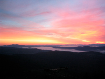
I can’t say enough to describe this mornings sunrise. It was amazing to see. The color made it look like the world was on fire. I’m so glad I stayed at Kid Gore. I enjoyed my evening with Dr. Doolittle and her two dogs. She was cool and had a lot of homemade gear, including the quilt I want to make. We talked a lot about everything.
I slept better but not great. My 3/4 pad keeps moving and I end up off it. I got going around 7:30 am. The hike started with a climb which sucked. Once I got warmed up I was moving. I passed a few beaver swamps that were beautiful.
I caught Allison a LT thru-hiker, who’s been right in front of me. We met up at Stratton Pond Trail Head. The trail up Stratton was tougher than I remembered. The whole trail is different than I remember from 2001. The views from the fire tower on top of Stratton Mtn. were great. The tower has a roof and glass windows. Someone put labels on the glass to indicate which mountains you were looking at.
Allison and I are both staying at Stratton Pond Shelter. Tomorrow its into Manchester Center to pick up my first resupply box at the post office.
Day 4
Sept. 11th
7:15 am to 10:10 pm
139 miles – 522.5 total miles
Stratton Pond Shelter to Bromley Mtn. Ski Hut
The day started at 3 am chasing mice off myself and moving my gear next to next to deter them. At one point I went face to face with one. He was only a foot away when he reached my tarp I was laying on.
I got up at 6 am and was going by 7:15 am. I made it to the road crossing in no time at all. It took me less than 3 hours to cover 10+ miles. I tried to hitch but started to walk after about 15 minutes. Finally a hotel owner picked me up and took me into town.
In town I went to EMS, got some pizza and a Coke, and went to the post office. I almost forgot to get a phone card and call my bother Mark. For my first town resupply since the AT I think it went pretty well. I got a hitch out of town pretty easy. I was in and out in two hours. So fast that I passed up getting any ice cream!
At the trail head I got ready for the next climb. On the climb up Bromley I met a Croo and one of them was the caretaker from Upper Goose Pond, who I met in 2001. There was a really cute girl working in the Croo too!
The new shelter was great. It had a huge privy with a wheelchair ramp. When I got there I couldn’t decide to stay or go. I was so mad at myself for all the indecision. It was totally crazy. I’d unpack some, then say “No I’m going!”. Only to sit back down and not leave. Then I’d pack more and say I was going again. I finally left after a hour and a half of playing mind games with myself.
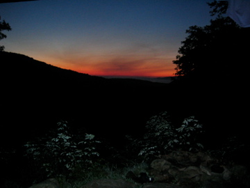
At the top Allison was there. We hung out and cooked on the rocks at the summit. The sunset was great but the moon rising was even better. It rose all red and slowly turned to yellow, then white.
We slept on the porch of the ski hut and two trail workers stayed inside. One was from England and the other Germany. Inside the hut smelled like dirty hikers. I was in bed at 7:50 pm.
I saw a Red Tailed Hawk at Vt. 11/30 and got within 20′.
Day 5
Sept. 12th
7:15 am to ? pm
17.2 miles – 78.1 total miles
Bromley Mtn. Ski Hut to Little Rock Pond Shelter
Last night the moon was so bright. The breeze kept the bugs away which was nice. I was up and out of camp by 7:15 am again.
I said goodbye to Allison since she was only going to Peru. Shortly after leaving I spooked a moose. I never saw it but it made a hell of a racket.
I talked to a young lady at Mad Tom Notch and then saw Allison again. Styles Peak was a tough little climb. I hung out at Griffen Lake. I almost forgot to get water, I had to turn around to do so. The descent to Lost Pond Shelter was as easy as I remember, and also to Big Branch where I had lunch. Five SOBO’s and a dog joined me. They were all cook and the dog was a cutie.
I actually took a break and enjoyed my lunch. I enjoyed what I had to eat too. From there the hiking was super easy. The route up to Little Rock Pond is really easy, then the trail got very rocky. The pond is beautiful and the shelter is right on the pond’s edge. Once again I got to camp early. I need the rest so I’m glad to be done early today. I also caught Poison Ivy. She’s from Mansfield, MA. So far it’s her and I.
I saw two snakes today.
Day 6
Sept. 13th
7:20 am to ? pm
19 miles – 87.1 total miles
Little Rock Pond to Government Shelter
I had a lot of time to sit at camp yesterday. I had a good talk with Poison Ivy. Dinner was good. We chatted until dark and hit the hay.
In the am I got out of camp at 7:30 am. The hiking was easy at first. White Rocks Mtn. was wonderful. The trees and terrain are unbelievable. Baker Mtn. was great too. It would be a good day hike from Rt. 7. I found a good tent spot at the view point at White Rocks but it was too early to stay.
The climb up Bear Mtn. was tough. I sweated bullets on the way up. Menervy Hichey Shelter was spooky as always. I made it to Rt. 103 by noon and went to Whistlestop for lunch. I had a burger, fries, and a chocolate milk shake. Before I left I made room for a small chocolate soft serve ice cream.
After lunch I made my way slowly to Government Clement Shelter. I saw a LT SOBO and three brothers SOBO from Texas. There’s two guys and their sons here and one LT NOBO. There’s also a family tenting.
A few ATV’s and one pick-up went by. It could be a noisy night. Poison Ivy gave me extra fuel so I don’t have to go to Rutland!
Day 7
Sept. 14th
? am to ? pm
23.7 miles – 110.7 total miles
Government Clement Shelter to David Logan Shelter
It was a noisy night. The ATV’s kept coming back every half hour. It really sucked. One of the guys there was ready to knock the guy off and kick his ass. The kids on the ATV’s would do two laps and yell, “Woohoo!. Wake up mother fuckers!”
Finally at 12 or so they left for good. I kinda slept in and got a later start than usual. It was wet from the rain in the am. Killington was not too bad of a climb. I spooked a Barred Owl. Got a good look at him and him me as he watched me from a branch.
The summit was fogged in and it rained shortly after I left Cooper’s Lodge. The sun did come out and I saw my shadow.
I checked out the new shelter on the way down from Pico. It was big in height but had no second bunk. Nice Though.
I made it down to the Inn at the Long Trail and bummed a shower off two LT thru-hikers. I also did laundry. I got a chicken sandwich and chips. It was so good. It took me three hours to get it all done. Once resupplied I hit the trail. I took my time and spooked a deer. I got to camp at 5:15pm
There was a bear and moose sighting at the shelter, plus a porky was known to climb right up on the sleeping platform. I made a rash decision to do 7.7 more miles to David Logan Shelter. It was HELL.
It was tough, long, and got dark before I got there. My first night hiking ever. I did not have fun. It was so humid, I sweated bullets the whole way.
Once to the shelter I found four others and took the table once more on my trip. Cooking took forever it seemed and I had a hard time finishing. It was a long, hot, wet day. I’m glad I did at least one 20 mile day. We heard a crazy animal noise before bed.
Day 8
Sept. 15th
? am to ? pm
12.6 miles – 123.3 total miles
David Logan Shelter to Sucker Brook Shelter
I slept okay. Probably better than I would have at Rolston Rest with porky. I slept in a bit. I took my time getting going as well. I was hurting right away. I took my time and met some other hikers. I had nice views to the northeast. I took a break at Sunrise Shelter then had lunch at Great Cliff.
I climbed on and sweated a ton more on my way to camp. I almost went on after cooking or so the plan was but was told it might rain. I’m here with Caddis, Bones and Doctor. I hope I feel more spring in my step tomorrow. The thighs were heavy today. Tomorrow it’s a 17.1 to Coley Glenn Shelter.
I saw four grouse today eight yesterday.
Day 9
Sept. 16th
7:40 am to ? pm
11.4 miles – 134.7 total miles
Sucker Brook Shelter to Emily Proctor Shelter
We went to bed to rain. The rain continued until the morning. From inside the shelter it sounded like it was still raining from the trees dropping drops on the time roof. We all slept in. I finally got up at 7:15 or so. I got going slowly. I felt no need to rush into the wet under brush.
My feet and shorts were quickly soaked. On top of Middlebury Ski Bowl I could some blue sky off in the distance. There was still hope for a dry afternoon.
The climb out from Rt. 125 was steep. I made it to Boyce Shelter around 12 or so. I pushed on to Skyline Lodge for lunch. I had a lazy lunch on the porch, rested my feet stretched, and dried out a bit.
A guy and girl came by. We all talked a bit then they left. Bones came next, then two guys with a dog and finally Doctor showed up.
I moved on to Emily Proctor but had mentally gave up on Cooley Glen before I left. Bones was only going there and I figured after tonight I’ll be alone since neither is doing my pace. We cut up a board from under the shelter with a hatchet that was there and had a fire. We collected other wood but it was all wet. The birch we got was great. The fire was wonderful. I enjoyed hanging with Bones. Turns out his buddies run/own ConsumptionJunction.com. CJ is actually what they call his house.
Tomorrow and Thursday it’s 19.5 and 18+. Tomorrow shouldn’t be too bad since I’ve done it before with Squiggy, but Thursday will be along Camel’s Hump. Off to bed.
Day 10
Sept. 17th
7:15 am to ? pm
19.5 miles – 154.2 total miles
Emily Proctor Shelter to Stark’s Nest
Last night was a cold and good for sleeping. Tonight it feels colder but I’m higher up without much protection. I could stay indoors here but I’ll take the porch just so I can say I slept outside all 18 days.
I got up around 6:30 am or so and was out of camp by 7:15 am. I said Happy Birthday to Bones and good bye, since I didn’t think I’d see him again.
No one is here at the Stark’s Next, at the moment and I doubt anyone will show up.
Today’s hike was good but very long at the end. The first half went fast with nice views of Killington to the South and Mt. Abraham to the North. Cooley Glen was filled with the group that had been at Skyline Lodge the night before. I’m glad I didn’t stay there. I had lunch at Lincoln Gap, then moved up Abraham. At the Battell Shelter I met a bunch of guys who knew all kinds of AT thru-hikers I did! It was really nice to hear names I hadn’t heard in a while.
I moved onto the summit of Abraham, then on to here. From Lincoln Peak onward I got so hungry. I was starving. Tomorrow I must eat a lot more during the day. It was a good thing I got an apple from a guy who came by during dinner. He was out for a hike after work. There was no H2O where I was told I would find some, and had to hike .3 miles down to Glen Ellen Lodge to get some.
Stark’s Nest is warn inside but the air is steal. It will be nice to come inside in the morning to eat and pack!
Day 11
Sept. 18th
7 am to ? pm
18.5 miles – 1172.7 total miles
Stark’s Nest to Banforth Ridge Shelter
Well I gave up sleeping outside at 1 am. Between the wind and the moon I was losing sleep which I knew I would need for today. Inside was nice expect for the mouse chewing in the wall.
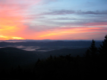
The sunrise was incredible! I sat looking out a window eating breakfast with the most beautiful sight so far!
I was out and going by 7 am. The climbs were long today but the descents were longer. My knees are killing me. They really hurt bad for the first time all trip. I had some issues with tight shins and calves earlier but today’s ups and downs kicked my but.
Water was hard to come by. Glen Birch had very little but there was a pin worm in it and it freaked the shit out of me. Even with a filter I wasn’t touching it. A guy Mark I met at Clement and a girl I met on the way up Glastonbury Mtn. were there and hiking together. Cowles Cave had H2O, Montclair Lodge was standing H2O and here is barely trickling.
The views today were great. Camel’s Hump was hard. It’s very steep and a long climb, but well worth it. It was windy and chilly on top but I can feel my face got sun. Lots of kids and day hikers were on top. The descent was horrible on the legs. The shelter seemed like it would never come. The water was downhill of course.
Tonight it’s myself and two older gentleman Dan “Old Swampy” and Neal.
Day 12
Sept. 19th
? am to ? pm
13.2 miles – 185.9 total miles
Banford Ridge to Buchanan Shelter
I slept well and had a great night with Dan and Neal. We were all up early and in town by 9:30am. I worried on the road that I was going the wrong way. I got a Coke, Ben & Jerry’s, and some candy.
Dan and Neal left and I hung out at the store. A GMC volunteer / thru-hiker (LT) talked to me a while. The sand in the parking lot was blowing all over.
The wind was very strong all day. Lots of blow down on the way up here. I stopped at Duckbrook Shelter and it was full of high school kids. I stayed a while then moved on. The climbs were so hard for me. I’m really hurting on the climbs. I have a slight sore throat so I wonder if I’m getting sick or if I’m just getting tired from no time off and the big days. I’m really dragging and having to stop on the climbs. I hope I get through it and get some power back.
I carried my H2O up here because the H2O had been hard to find. There was H2O! I was upset.
Day 13
Sept. 20th
? am to ? pm
10.9 miles – 196.8 total miles
Buchanan Shelter to Butler Lodge
Myself and the rest of the hikers had good talks, then it was off to a restful sleep. It was super windy and it was muggy too.
I developed a cough and its much worse today. My energy has never been so low. Any climb over a medium grade puts me into the red zone. My breathing is labored and I feel sick. I have now developed a headache as well.
Someone had put kryptonite in Scatman’s pack. He has lost his former climbing prowess. Having no energy has effected my mental state as well. I’m definitely down and today’s rain didn’t help.
I was to go 14.5 but I’m not sure if I’ll make the end right now. I’m waiting for a call from home or Chris Novak. I hope a coupe days off will cure me. I’m sure hope so. I don’t want to quit but I also know if I continue to feel this way I’ll hate the rest of the trip.
Day 14
Sept. 21st
7:20 am to ? pm
9.0 miles – 205.8 total miles
Butler Lodge to Watson Camp
I took my nap but still felt like crap the rest of the day. Bed came early and was up once to pee.
I got up late, 6:33 am and was going by 7:20 am. The climb wasn’t bad and I coughed up some phlegm. I caught Popcorn and +1. We hiked down together and caught a ride to town from a couple from Lexington, MA. We waited around for the pizza place to open, then ate up a storm. Later Popcorn’s wife showed up and gave us a ride to the store and me to the trail. Those guys were cool.
I hiked up to Sterling Pond with intentions to tarp but I took too much time talking and eating I’m in for the night. The girl here is cool and her friend showed up. They are encouraging me to pink blaze to catch two girls in front of me. We’ll see.
Day 15
Sept. 22nd
? am to ? pm
19.7 miles – 225.5 total miles
Watson Camp to Laraway Lookout
I had an awesome time with Jesslyn and Brianna the two caretakers. They got drunk on wine. I was going to leave so they could but someone else showed up. Then that person left to Sterling Pond Shelter when they realized the girls weren’t going to be quiet.
We stayed up till 10 pm. They were a riot. I had a blast.
I left around 7:15 for Johnson. The hike up Whiteface was steep but after that it was all down hill and mostly dirt roads. I got to town at 11:45 and the two girls were hitching in front of the Long Trail Tavern. I went with them and got a Coke, chips, and a banana, then walked back to the tavern. I sat from 12:30 or so to 2:45 waiting to get my package. They don’t open till 3 or 4 pm.
Some guy pulled in right after me but it seemed he was only splitting wood behind the place. Then a guy on a motorcycle pulls up and goes out back. A half hour later I hear them and they’re inside drinking. I was bummed. I went around back and ask for my package and got it.
It was a quick pack job and off to the woods. I realized also I only have 3.5 days left. I’ll finish before Friday now. The hike wasn’t bad to the first shelter. I stayed a bit, talked with the girls, then pushed on. Only because my plan had me only 3 days of food. I should have bought more in town and taken my time.
Instead I did a 19.7 on the first day I felt better and I didn’t drink shit for water today. I’m so pigheaded at times. I can hike this section in 3.5 days but I should take 4.5. I still have no ride and being still not 100% I should go easy. I just find it hard to to push when I only have under 50 miles to go. I can sense the end, and I think I want it to end.
Day 16
Sept. 23rd
7:20 am to 3:45 pm
18.0 miles – 243.5 total miles
Laraway Lookout to Tillotson Camp
Day 4 of Rain
Last nights sleep sucked. It was a terrible nights sleep, windy, slopped, and I was uneasy. It rained at 4:30 or so and has only stopped twice. It’s not now but it looks like it could. Today was an 18 mile slush through the rain. I was hating life today but after I thought about those poor AT hikers who had almost 60 days straight of rain. It was wet wet wet. I walked through rivers of rain water.
At Spruce Camp I met two ladies. Nicole and I forget the others name. They were very fun to talk to.
At Tilloston Camp it’s myself and two other guys Eric and Andrew. When I got here I was so cold and miserable. Just now my bag doesn’t feel damp. Since it stopped raining it doesn’t seem as wet.
I have 1.5 days left I hope its sunny tomorrow. I have a lot of shit to dry out. If all works out I hope to hitch to Stowe, where I’ll buy pizza and beer to bring up to Watson Camp from Brianna. I also hope that Nicole and her friend will be there.
Day 17
Sept. 24th
? am to ? pm
14.6 miles – 258.1 total miles (+2 miles for Big J)
Tillotson Camp to Laura Woodward Shelter
Last nights camp was on a serious angle. All night I was falling one direction. I didn’t sleep well as a result.
Today was a very nice day. Lots of sun and my stuff is dry again. Except my shoes! I was feeling sluggish after the two long days. I didn’t drink nearly enough H2O today. I have to work on that! I was slow on the climbs as a results. I didn’t eat until almost 2 pm but I snacked. I have lots of extra candy. Jay Peak wasn’t all that bad and Big Jay’s so-called bushwhack was a joke. It was easier to follow than parts of the Long Trail. Didn’t see many people. I dried my stuff out in the ski lodge on top of Jay.
I think I’m alone tonight for the third time. We’ll see. Today was just another day, lots of grouse and up and down.
Day 18
Sept. 25th
6:23 am to 9:26 am
8.7 miles – 272 total miles (2.6 extra back to highway)
Laura Woodward to Canada (to Watson Camp)
I was to bed early last night, not much less to do. I set the alarm for 5:45 am but I was up even before it. I ate in the dark and packed. I was out of camp by 6:23 am.
All Peak was a pain with no warm up After that it was easy. Shooting Star Shelter was a nice camp. I flew downwards to the road then up Carleton Mtn. After that it was 1.4 miles to the border. I finished at 9:26 am.
I hiked back to the road and the 1st car I thumbed stopped. That got me to 100/101. I walked a mile or two and another car picked me up. That one got me to Jefferson. Next I got a hitch half way up the notch. Then one to the top. Finally the 5th hitch got me to Pie in the Sky, the pizza store from Sunday. I ate pizza and got one to go, then got beer. Another hitch back to the notch. Then it was a 1.4 hike to camp.
But nobody is here! A northbound “Jitterbug” is here, but that’s it. I hope Brianne shows up or Nicole and Polly. If not I’m eating pizza again!
It’s raining and cold now.
Final Thoughts
The mountains of Vermont have been and still are some of my favorite. I truly love the Long Trail. At the time this trip happened I learned a lot. It was the first time I was faced with a health issue on trail and the start of my journey into carrying less.
I meet some amazing people, sharing many miles and great nights socializing with them. Revisiting the Appalachian Trail (AT) was also quite special, as well as experiencing the northern section of the trail and all it’s ruggedness.
Overall this trip was quite interesting on many levels. It was not only my first major hike after doing the AT but also my first go at light weight hiking.
As I look back on it now, after my Triple Crown and with what I know now, I see how different my mindset was back then. I was still a Shelter Rat (person who only considers and stays in shelters) and my concept of a big day was still limited by what I did on the AT.


